Oklahomans should be prepared for potential severe weather developing later today, Tuesday, April 29, 2025, according to State Climatologist Gary McManus.
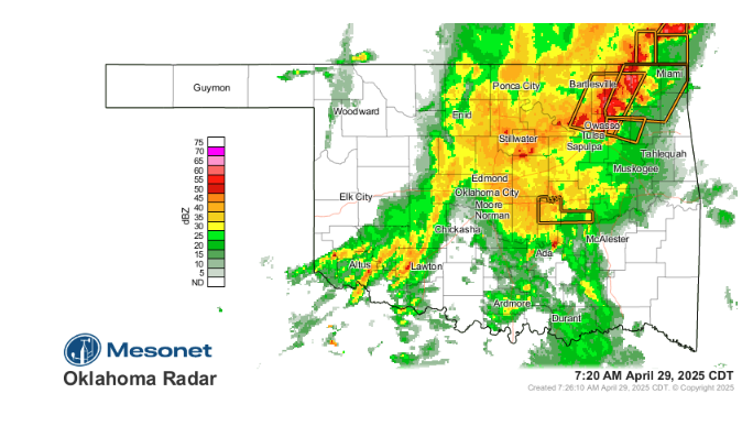
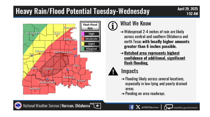
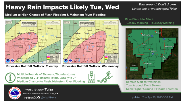
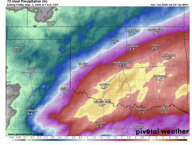
Dubbed “The Cold Front Edition” by McManus, the severe weather threat stems from storms expected to form this afternoon along a cold front moving into the region. While severe thunderstorms, possibly bringing large hail, are a concern, the primary hazard may be heavy rainfall leading to flash flooding.
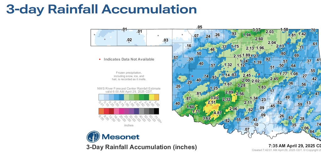
Significant rainfall is anticipated not just today but over the next three days, increasing the risk of flash floods across affected areas. McManus emphasizes that flash flooding could pose the most significant danger from this weather system.
For those seeking relative safety, McManus notes that being located north of the advancing cold front will likely limit the potential for both severe storms and flash flooding.
Residents statewide are urged to stay vigilant and “weather aware” throughout the day and the coming days. Crucially, McManus stresses the importance of being “flooded roadway aware,” reminding everyone that avoiding driving through floodwaters is a potentially life-saving decision.
Stay tuned to local weather forecasts and alerts for updates on storm development and specific warnings for your area.
To read more from Gary McManus on his mesonet ticker, click here: