

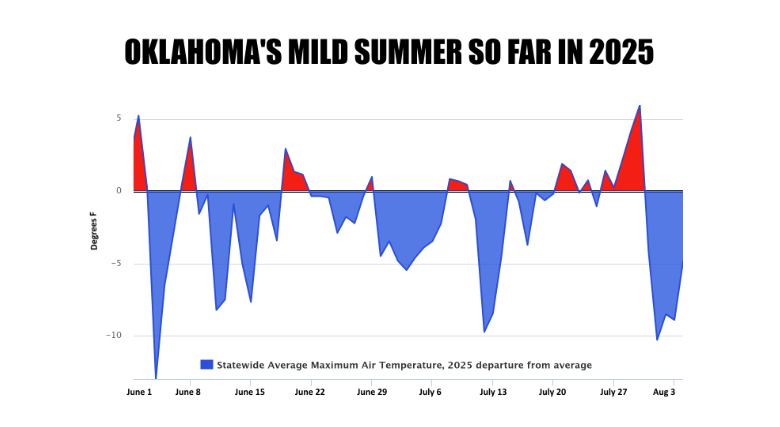
After a pleasant, unseasonably mild stretch of weather, Oklahomans are being reminded that it is, in fact, still August. According to State Climatologist Gary McManus, the state is transitioning back to a more typical weather pattern after a “burst of late-September weather” that saw temperatures drop over the past week.
“Yesterday marked a transition from that burst of late-September weather, back to early August,” McManus stated. “So we’re back in the saddle again.”

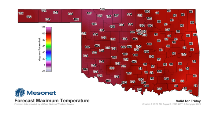
The milder temperatures, which were a welcome change for many, are being replaced by a more familiar late-summer heat. The warmth is expected to intensify, with the peak heat arriving on Friday. This hot spell is forecasted to persist throughout the weekend and into the early part of next week.
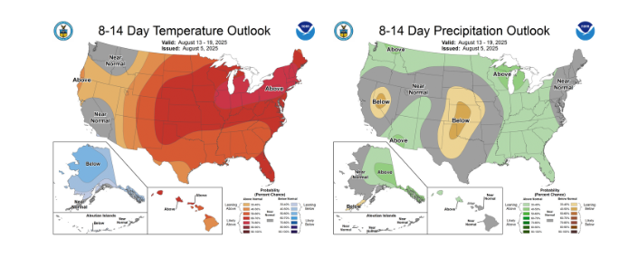
McManus’s forecast indicates that while a “cold (i.e., kinda cool) front” is on the horizon, it won’t bring significant relief in the form of rainfall. The front is expected to bring a slight cooling trend, but not enough to drastically change the overall weather pattern.

The State Climatologist offered a simple reminder for residents bracing for the return of the heat: “But, as a reminder, it’s August, so get used to this for awhile.” His words serve as a clear message that while the recent mild weather was a nice break, the state is now settling back into its typical late-summer conditions.
To read more from Gary McManus on his Mesonet Ticker, click here:


