A Red Flag Warning is currently in effect for Western Oklahoma and the Oklahoma Panhandle as a cold front moves across the state. The combination of strong northerly winds, very dry air, and dormant vegetation has created a highly volatile environment for wildfires.
State officials warn that any established wildfire today will have the potential for rapid spread, particularly in areas dominated by tall grass and range fuels. Fire danger is expected to remain high through the weekend.
Critical Conditions: What is Driving the Threat?
The primary drivers for today’s elevated fire danger are post-frontal conditions:
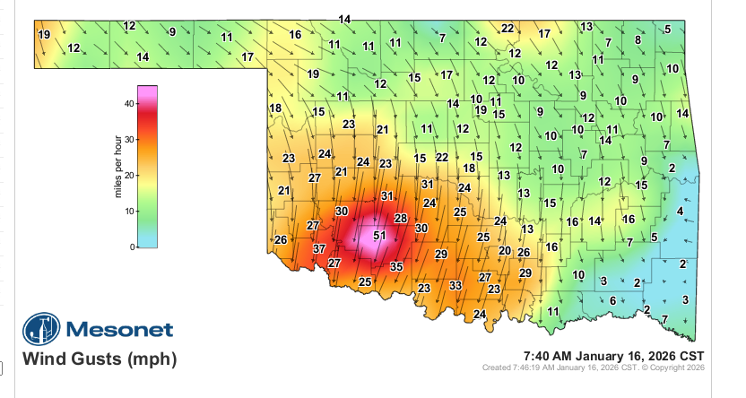
- Strong Winds: Northerly winds are expected to gust between 25–40+ mph, depending on the region.
- Very Dry Air: Relative humidity values will drop significantly (11–20%), drying out vegetation rapidly.
- Receptive Fuels: Grass and timber remain dormant and dry. Even in areas with overnight moisture recovery, the dry air will quickly make fuels susceptible to burning by midday.
Regional Fire Weather Breakdown
1. Western & Southwestern Oklahoma (Highest Threat)
This region faces the most critical conditions.
- Wind: Northwest winds sustained at 19–28 mph with gusts exceeding 40 mph.
- Humidity: Extremely low (11–18%).
- Fire Behavior: Fires in rangeland fuels could spread at rates of 200–280 feet per minute (approx. 2.7–3.4 mph) with flame lengths up to 20 feet.
- Timing: Peak danger occurs midday through the evening. Winds may relax slightly after sunset, but breezy conditions will keep fire danger active into the night.
2. Oklahoma Panhandle & Northwestern Oklahoma
- Wind: Moderate northwest winds increasing to 25 mph (gusts up to 35 mph).
- Humidity: 16–21%.
- Fire Behavior: Spread rates estimated at 185–270 feet per minute (2.5 mph).
- Note: Despite temperatures starting near freezing, the dry air will support an extended burning period well past sunset.
3. North-Central & Northeastern Oklahoma
- Wind: Northwest winds sustained at 15–24 mph (gusts topping 30 mph).
- Fire Behavior: While overnight moisture was better here, fuels will become receptive by midday. Grass fires may spread at 135–190 feet per minute. Timber fires will be slower but still resistant to control.
4. South-Central & Southeastern Oklahoma
- Wind: Northwest winds 10–19 mph (gusts 20–25 mph).
- Fire Behavior: Moderate to rapid rates of spread are expected. Grass fires may reach speeds of 120–170 feet per minute.
Weekend & Long-Term Outlook
Saturday Forecast: The threat does not end tonight. Despite cooler temperatures and potential flurries in western parts of the state tomorrow morning, very dry air will blanket the entire state. Relative humidity will hover around 20% statewide. While winds may be slightly less intense (11–19 mph), the fire danger remains elevated.
Looking Ahead: High fire danger indices are expected to persist into next week. While there are low chances of rain later in the week, current forecasts suggest amounts will be minimal and unlikely to provide significant relief.
Resources & Safety
Resource Requests:
- Resource Hotline: (800) 800-2481
- OFS Suppression Groups are positioned in Weatherford and Guthrie.
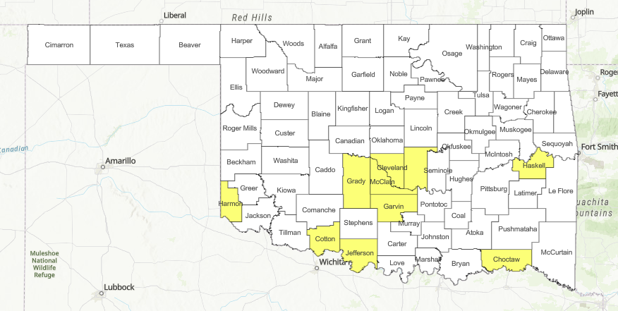
Action Required: Residents should exercise extreme caution. Avoid any outdoor activities that could generate sparks or open flames. Check local listings for active County Burn Bans before considering any burning.