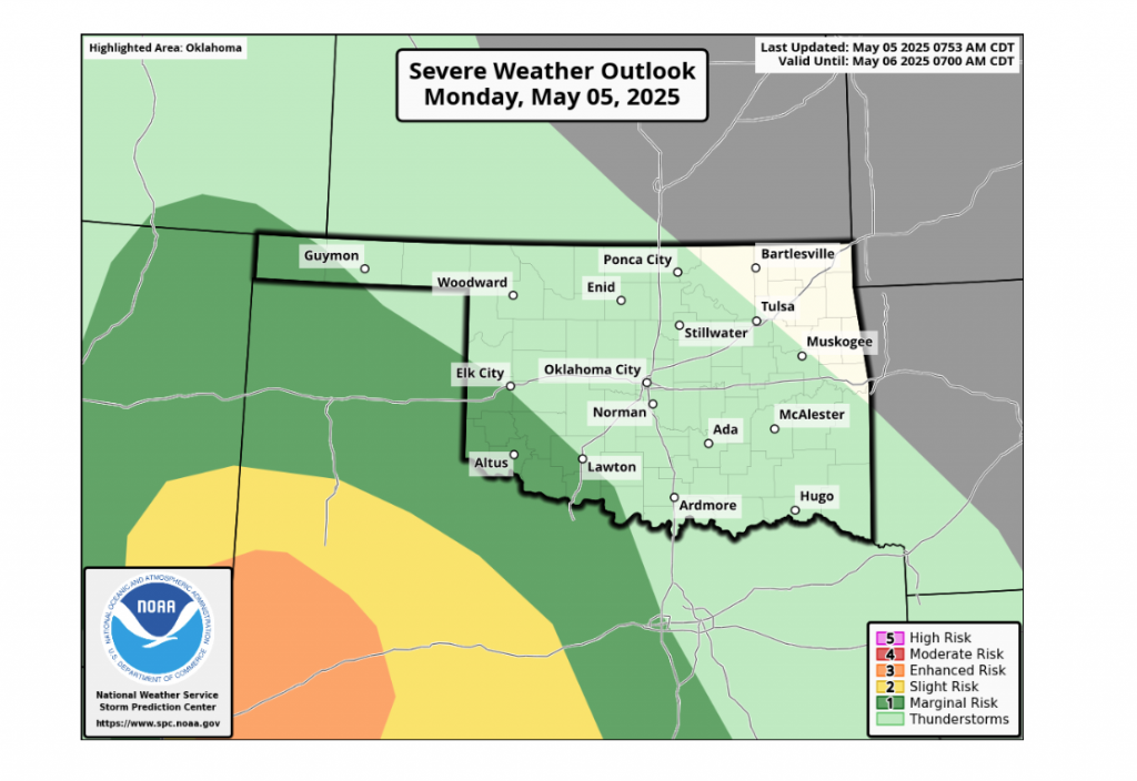
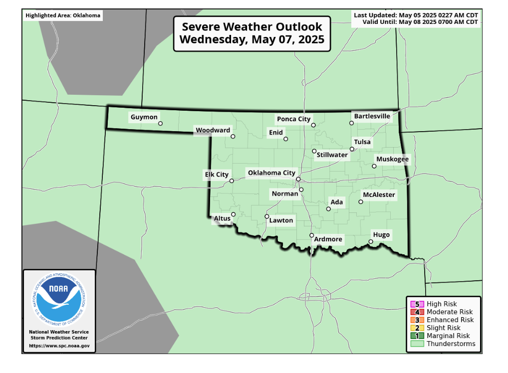
Oklahoma is bracing for another week of wet weather, with rain beginning tonight and continuing throughout the week. According to State Climatologist Gary McManus, while there’s a chance for some strong-to-severe storms, Oklahomans shouldn’t expect the kind of widespread, intense severe weather typically seen in May.
“We’ll see chances for some strong-to-severe storms, but not big-time May severe weather like we’ve seen in the past,” McManus stated. He also offered a seasonal outlook, suggesting a potential shift in weather patterns. “That’s more like June than May, which probably means July will be more like June, and that’s fine until September is like August, and even worse when October is like September.”
The already saturated ground across the state has prompted concerns about flooding. “Given our saturated soils, we see yet another big flash flood watch across the SW two-thirds of the state, but really anywhere could see flooding,” McManus cautioned.
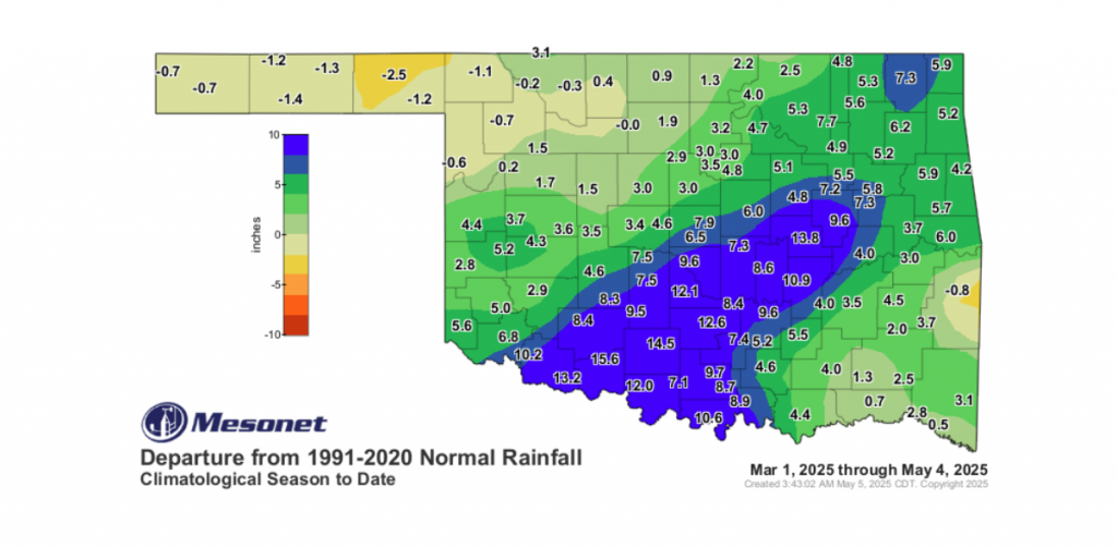
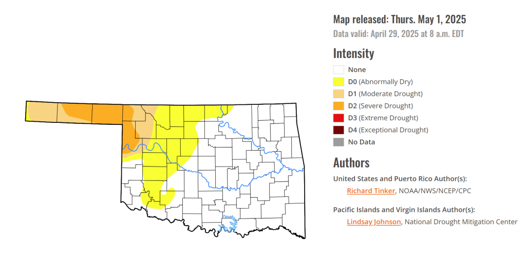
Interestingly, despite the recent record-breaking rainfall in April for Oklahoma, some parts of the state are still experiencing a deficit. “We really need those rains to hit up in the Panhandle and far NW OK, though, because believe it or not, and listen to me now but believe me later, they’re still in deficit even after the wettest April on record for Oklahoma,” McManus explained.
For those hoping for warmer temperatures, the forecast brings disappointing news. “Now, the saddest news of all I see no high temperatures above 80 degrees for the 7 days,” McManus noted.

While the rain is welcome in the panhandle and northwestern regions, the cooler temperatures will likely persist for the next seven days.