

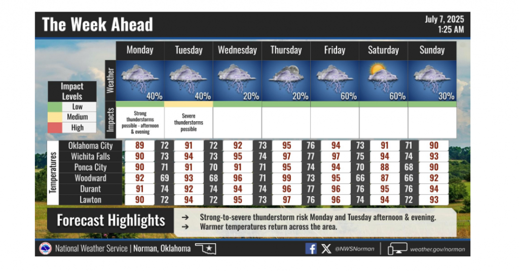
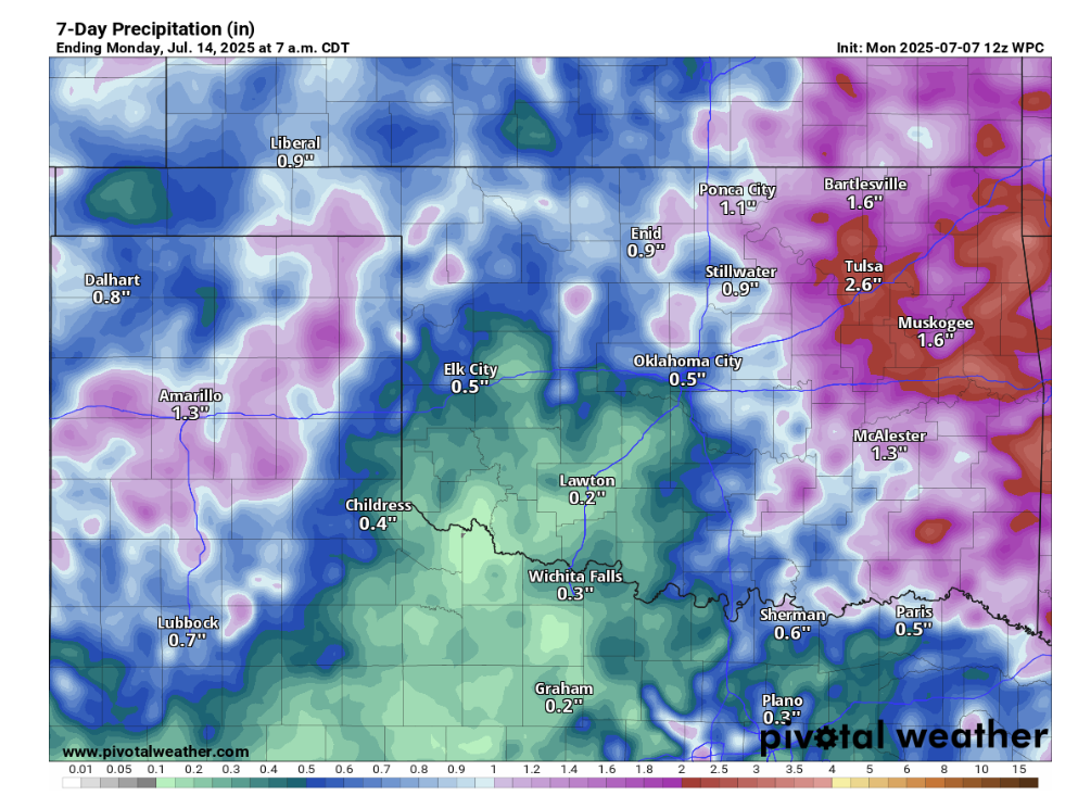
Oklahoma is bracing for a short-lived return of summer heat this week, but residents shouldn’t expect a prolonged scorcher. According to State Climatologist Gary McManus, the warmer temperatures will be fleeting, with another cool-down and rain chances on the horizon.
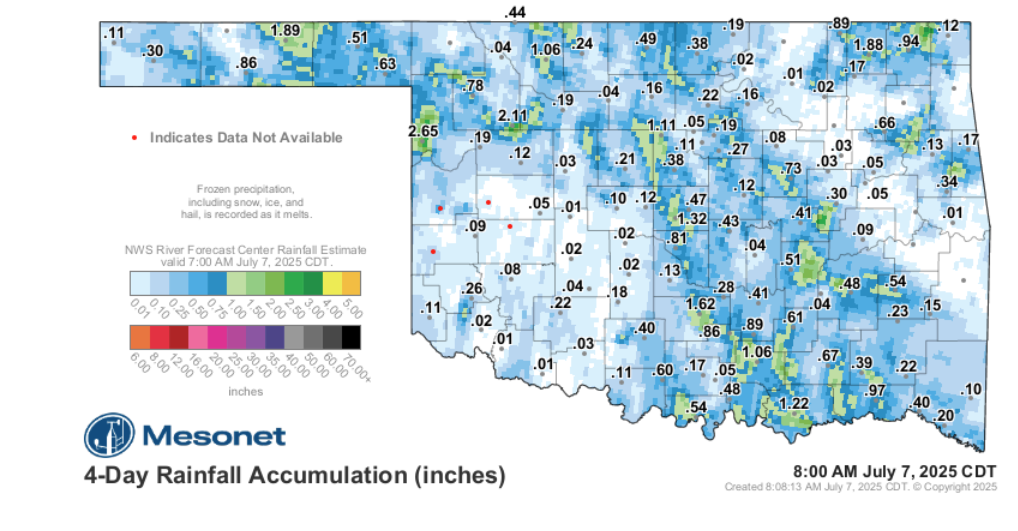
“So far, we’ve had very little in the way of heat wavy material to work with,” McManus noted, reflecting on the season’s mildness. He added, “Even now, after the long holiday weekend, we dealt with more rain than heat!”
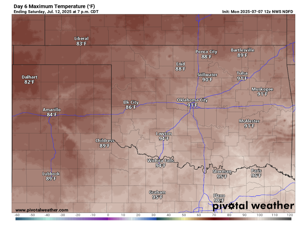
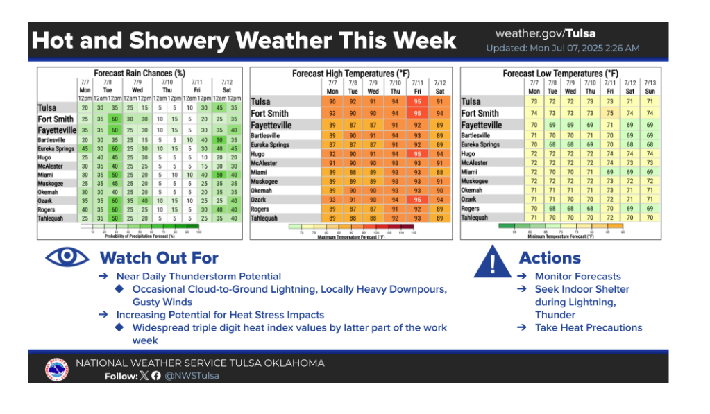
The mercury is expected to climb again this week, with Thursday looking like the hottest day. However, relief is on its way. “Then we get another cold front Friday, more rain chances, and then another Saturday meant more for June than July,” McManus explained, suggesting a pattern more typical of early summer than mid-July.
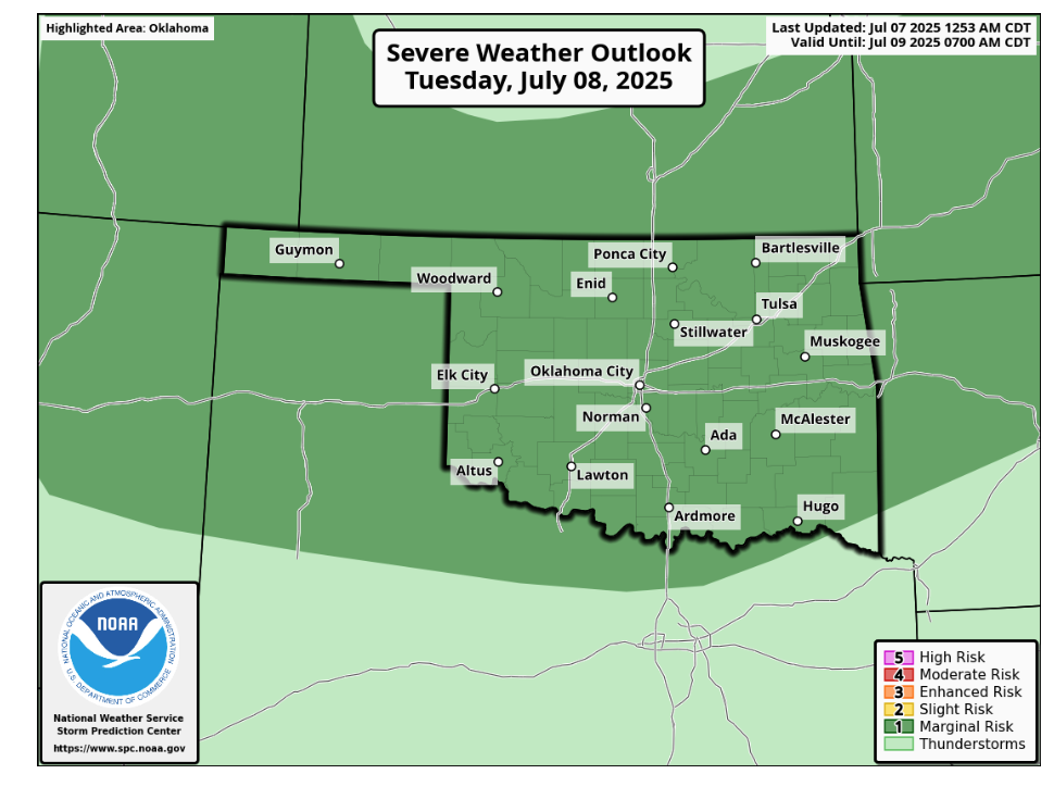
While some severe weather is possible, especially on Tuesday, McManus anticipates it will primarily manifest as severe winds—a common occurrence during summer thunderstorms, which he likened to the aftermath of “eating Taco Bell.” He reassured that this activity is “Pretty normal for July thunderstorms, even during uncommon July weather.”
Crucially, there’s no immediate threat of a “dreaded heat dome” forming over the state, offering Oklahomans a reprieve from the intense, stagnant heat waves that can often define summer.
To read more from Gary McManus on his mesonet ticker, click here:


