

The Oklahoma Forestry Services (OFS) reports a complex weather pattern today, creating a “bimodal threat” that pits high wildfire danger in the western regions against potential severe weather and rain across the rest of the state. While much of Oklahoma prepares for moisture, a dry air wedge in the Panhandle and far western counties has officials on high alert for erratic fire behavior.
Current Fire Activity and Containment
Recent suppression efforts have successfully brought several large fires to full containment, though active incidents persist in the eastern half of the state.
Significant Fire Updates:
- Doke Two (Atoka County): 2,273 acres, 100% contained.
- Bascom Road Fire (Pittsburg County): 950 acres, 70% contained.
- Goats Rock Fire (McCurtain County): 276 acres, 100% contained.
- 428 Fire (LeFlore County): 250 acres, 60% contained.
- Ty Fire (Pushmataha County): 161 acres, 100% contained.
- North San Bois Fire (Haskell County): 161 acres, 60% contained.
In the last reporting period, the Northeast, East-Central, and Southeast areas recorded 10 fires burning a combined 421 acres. Causes were attributed to incendiary activity and escaped control burns. Local fire departments also suppressed nine additional fires totaling 12 acres.
Regional Weather and Fire Outlook
A cold front moving through the state is creating a sharp divide in fuel receptiveness and fire risk.
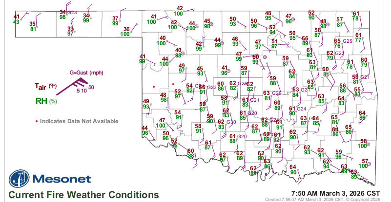
The Panhandle and Northwest Oklahoma The western Panhandle faces near-critical fire weather today. Temperatures in the 70s, combined with humidity levels as low as 12-20% and dry fuels, will support aggressive fire spread. Northerly winds gusting to 25 mph are expected to arrive with the frontal boundary, potentially causing head fire rates of spread between 150-300 feet per minute and flame lengths reaching up to 25 feet in heavy grass.
Western and Southwest Oklahoma The fire threat is concentrated in the western tier of counties this afternoon. High temperatures (78°–88°F) and low humidity (14-25%) will make fine fuels highly receptive. Sustained southwest winds of 12-17 mph could push fire spread rates to 230 feet per minute. Conditions are expected to moderate this evening as the front introduces rain and storm chances.
Central and Eastern Oklahoma Fire danger remains moderated in these regions due to elevated dewpoints and humidity levels staying above 40-45%. Cloud cover and impending rain chances this evening will keep fuel moisture levels high enough to limit significant fire activity.
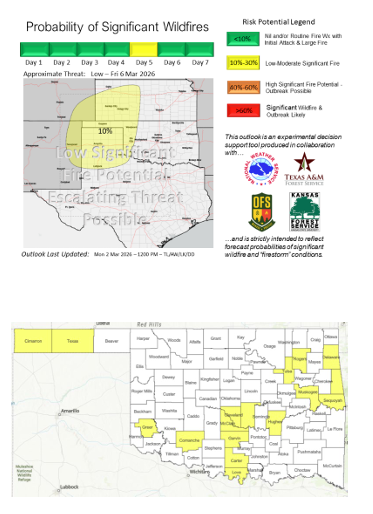
Extended Forecast
While Wednesday is expected to offer a reprieve with moist air and relaxed winds across most of the state, fire officials are monitoring a “dryline intrusion” projected for Friday. This system could reintroduce wildfire concerns to far western Oklahoma while sparking severe weather potential for the eastern half of the state.
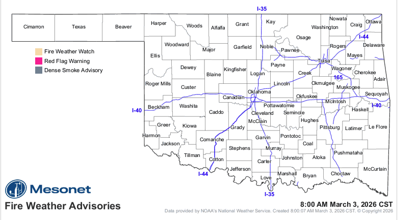
OFS has positioned suppression groups, including engines and dozers, in Guymon and Woodward to respond to any new starts in the high-risk western corridors.


