

Oklahomans are waking up to a heavy, humid atmosphere as the state prepares for significant Oklahoma severe storms and a giant hail risk today. State Climatologist Gary McManus noted the shift in the air this morning, remarking that it already feels like the peak of storm season. “One of THOSE days, when you wake up in the morning, go outside and your glasses fog over,” McManus said. “You can smell it, you can feel it, you can almost taste all that moisture in the air. Almost feels like May.”
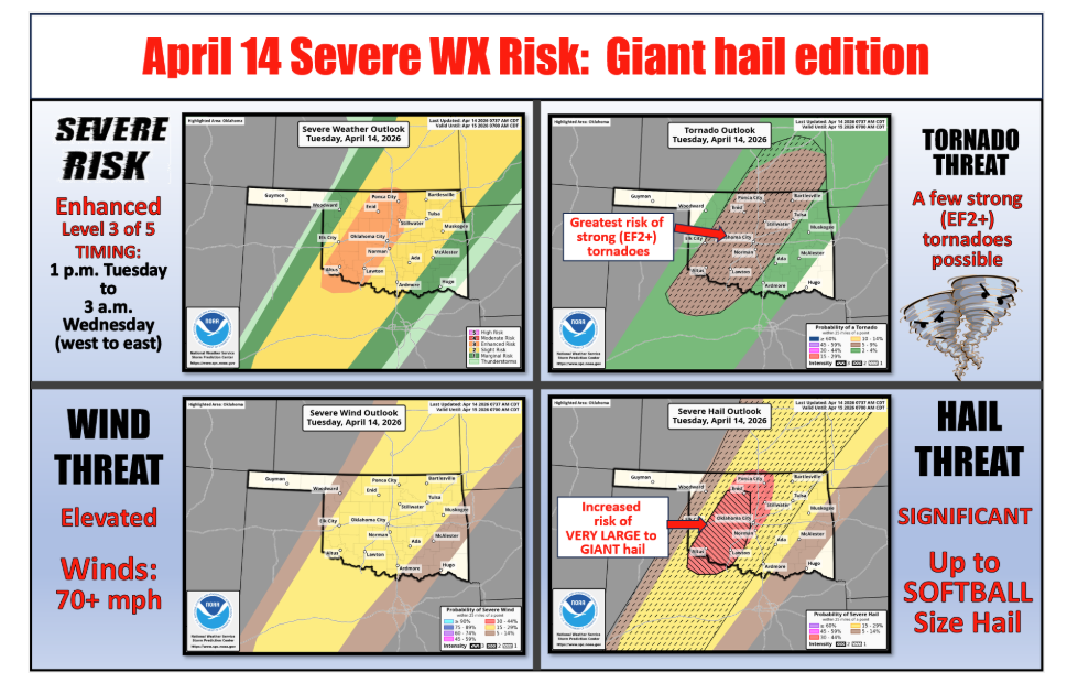
Severe Threats and Level 3 Enhanced Risk
The Storm Prediction Center has upgraded portions of the state to an “Enhanced” risk, which is a level 3 out of 5 on their scale. This change is driven primarily by the potential for very large, destructive hail. While the storms may remain scattered, those that do develop are expected to be intense.
“There’s a good chance somebody’s getting a new roof today,” McManus warned. “That threat of the giant hail is the reason SPC upgraded that portion of the state from ‘slight’ to ‘enhanced.’ It’ll also put knots in your noggin faster than you can rub them, so keep that in mind so you can keep your mind.”
Dryline Dynamics and Tornado Potential
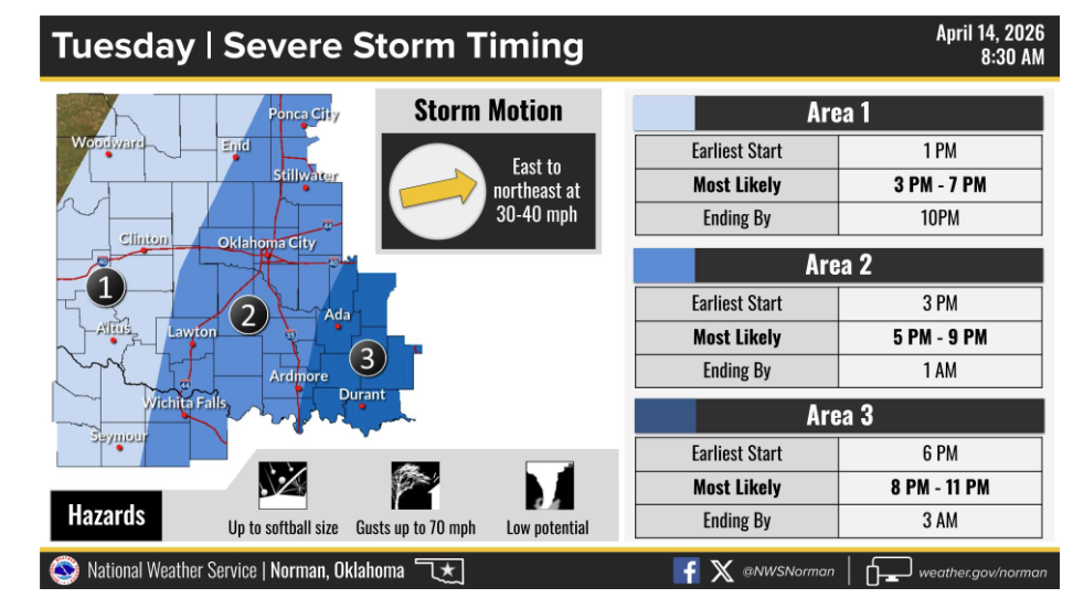
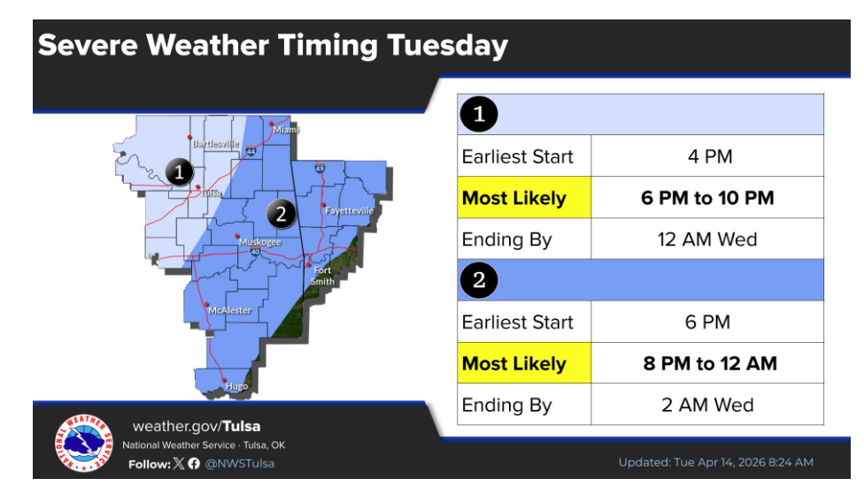
As a weak wave moves overhead, storms are expected to fire along and to the east of a dryline currently visible in Northwest Oklahoma. These storms will have a highly unstable environment to work with, leading to concerns about “havoc and mayhem” starting in the late afternoon and continuing into the evening. While hail is the primary concern, McManus noted a chance of tornadoes as well.
Conversely, the area to the west of the dryline faces a completely different set of hazards. “While that’s all going on to the east of the dryline, we continue with big-time fire danger to the west and a Red Flag Fire Warning in far Northwest Oklahoma and the Panhandle,” McManus said.
Safety and Preparation
As the situation evolves, residents are encouraged to stay weather-aware and check in on family members. Farm Director KC Sheperd reminds listeners to have multiple ways to receive warnings and to ensure their severe weather safety plans are ready to be put into action.
McManus emphasized the importance of looking out for others and your animals.
For the latest updates on the changing forecast, stay tuned to your local National Weather Service office and your favorite media sources throughout the evening.
To read more from State Climatologist Gary McManus on his mesonet ticker, click here:


