Oklahomans are facing a complex and dangerous weather setup today as a strong cold front, a dryline, and a low-pressure system converge to create a “triple point” of severe potential. State Climatologist Gary McManus indicates that this combination will trigger a variety of hazards across the state, ranging from life-threatening storms to heightened fire conditions.
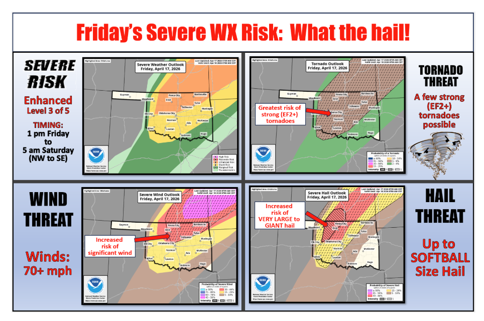
Severe Storms and Tornado Potential
The area near the intersection of the cold front, dryline, and surface low is under an enhanced risk for severe weather. Forecasters are particularly concerned about “bigtime” hail, with the potential for stones reaching the size of softballs.
As the day unfolds, the risk for significant tornadoes (EF2 or greater) will increase from Northwest into Central Oklahoma. These threats will emerge from two different storm modes:
- Supercells: Developing off the dryline during the afternoon.
- QLCS (Quasi-Linear Convective System): Storms forming along the front later in the evening, capable of producing quick spin-up tornadoes and damaging winds.
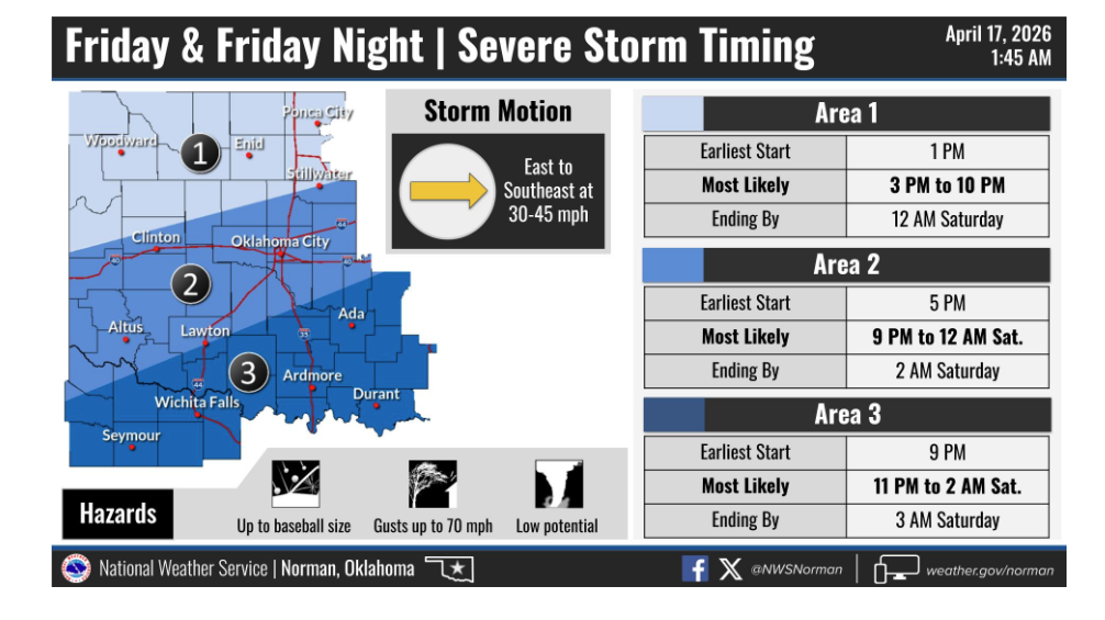
The timing for these developments spans from early this afternoon through tomorrow morning, progressing from Northwest to Southeast Oklahoma.
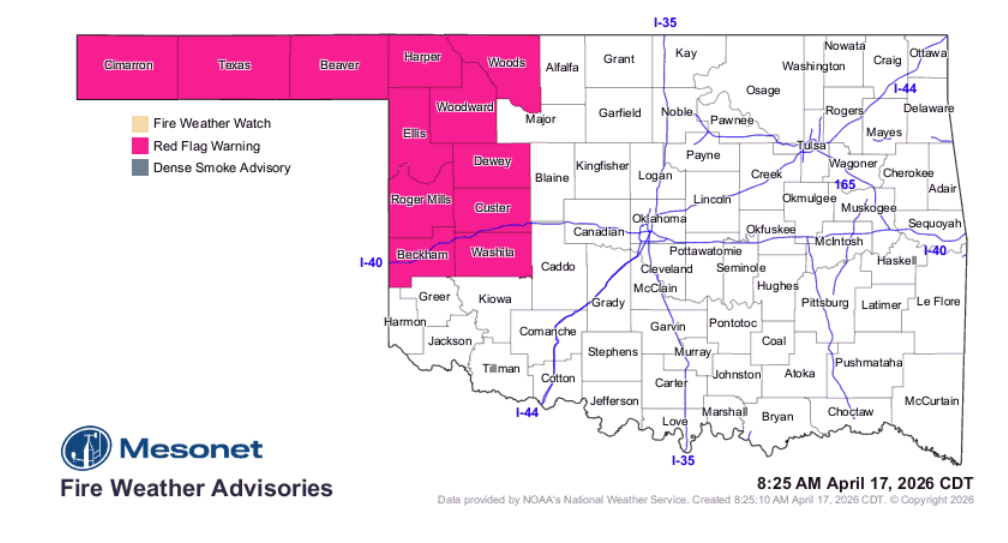
Fire Weather and High Winds
While eastern and central parts of the state brace for storms, Western Oklahoma remains under a Red Flag Fire Warning. To the west of the dryline, conditions remain critically dry, keeping fire danger heightened.
Adding to the volatility, extreme winds are expected both ahead of and behind the cold front. Wind gusts could exceed 50 mph across the region, complicating travel and increasing the risk of rapid wildfire spread.
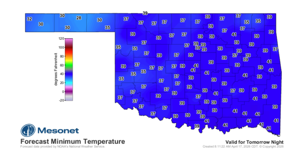
Panhandle Freeze and State Outlook
As the system clears out over the weekend, the Oklahoma Panhandle is expected to see a sharp drop in temperatures, with freezing conditions likely.
Every part of the state faces some level of risk today, whether from wildfires, massive hail, tornadoes, or severe straight-line winds. Residents are encouraged to remain weather-aware as this system moves through.