

Oklahoma is currently locked in a battle with standard summer weather, but a massive shift in the tropical Pacific Ocean is about to reshape the long-term weather outlook. State Climatologist Gary McManus highlights that while short-term forecasts feature intense heat and severe storms, the big news is the official arrival of El Niño.
Before looking months down the road, Oklahoma has plenty of active weather to handle this week.
Short-Term Forecast: Intense Heat and Cold Front Details
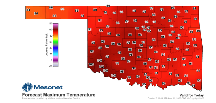
The immediate weather concern is extreme heat along the Interstate 44 corridor, where heat index values are expected to reach 105-110 degrees.
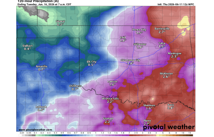
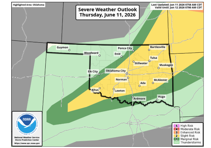
Relief is on the horizon, but it arrives with the threat of severe weather. A cold front pushing to the southeast brings a risk of severe storms. Forecasters warn residents to watch for golf-ball-sized hail and wind gusts reaching up to 70 mph. While the tornado threat remains very low, it is not completely zero. Following the front, a lovely weather pattern settles in by Sunday, accompanied by the potential for significant rainfall across the state over the next five days.
The Pacific Takes the Microphone: El Niño Arrives
Shifting focus to global patterns, NOAA’s Climate Prediction Center issued an official El Niño Advisory. This announcement confirms that El Niño conditions have officially developed in the tropical Pacific.
The ocean and the atmosphere are now working together. Observations show warmer-than-average sea surface temperatures across the central and eastern equatorial Pacific, substantial subsurface warmth, westerly wind anomalies near the ocean surface, easterly wind anomalies aloft, and negative Southern Oscillation Index values.
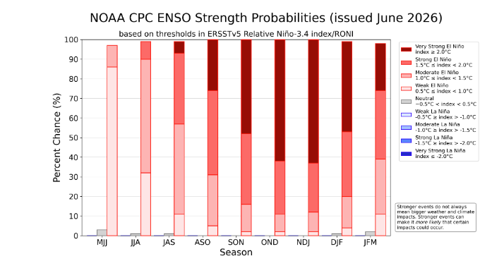
The Climate Prediction Center’s June outlook indicates an incredibly high probability of this climate phase, with a 97% chance of El Niño for the May–July period and a 99% chance for June–August. These high probabilities dominate the forecast all the way into early next spring.
The data gets even more striking looking ahead toward the colder months. For the November–January timeframe, the Climate Prediction Center shows a 25% chance of a strong El Niño and a 63% chance of a very strong El Niño. Combined, that represents an 88% chance of a strong or super-strong pattern during the heart of winter.
What This Means for Oklahoma
McManus cautions that weather patterns are rarely straightforward. A strong El Niño does not guarantee a wet, snowy, or mild winter for Oklahoma, because the strength of the global climate phenomenon does not automatically translate to the strength of local impacts.
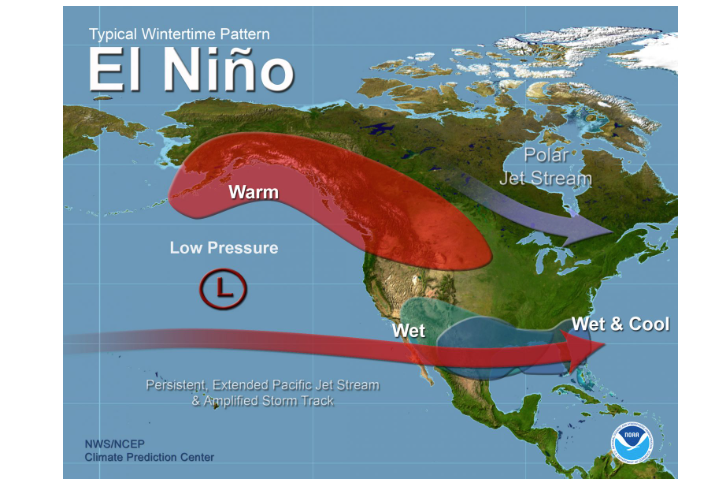
However, a stronger El Niño skews the odds more heavily toward classic cool-season patterns across the Southern United States. This development will be worth monitoring closely throughout the summer and fall.
It is also important to remember that El Niño is not a light switch. Its development on a Thursday does not mean it instantly steers every thunderstorm into Oklahoma on Friday. During the early summer, the Pacific’s influence on North American weather is subtle and less reliable because the jet stream is weaker.
For the time being, Oklahoma’s late-spring and early-summer rainfall will continue to depend on traditional regional drivers:
- Gulf of Mexico moisture
- Passing cold fronts and upper-level disturbances
- Organized storm complexes
- The Madden-Julian Oscillation (MJO) and localized atmospheric variability
While the long-term pattern begins to shift in the background, Oklahoma remains tied to typical summer dynamics for the immediate future. Still, forecasters agree that a transition into El Niño is a welcome change from the prolonged La Niña patterns of recent years.
To read more from State Climatologist Gary McManus on his mesonet ticker, click here:


