

A powerful, destructive line of thunderstorms ripped through western and central Oklahoma during the overnight hours of Sunday into early Monday morning, June 22, triggering rare “destructive” warnings for the Oklahoma City metropolitan area.
The National Weather Service issued its highest tier of severe thunderstorm warnings just after 1 a.m. CT as the fast-moving complex brought exceptional wind gusts and widespread power flashes to the region.
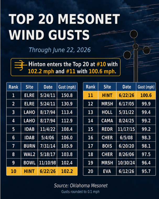
Hurricane-Force Winds Top 100 MPH
The defining characteristic of last night’s system was widespread, intense straight-line winds. The storm raked across the state’s central corridors after midnight, leading to extreme data points captured by the Oklahoma Mesonet:
- 102 MPH Wind Gust: Recorded at the Hinton Mesonet site in Caddo County, roughly 50 miles west of Oklahoma City.
- Widespread 80+ MPH Gusts: Severe gusts hammered numerous communities across western and central Oklahoma as the shelf cloud advanced.
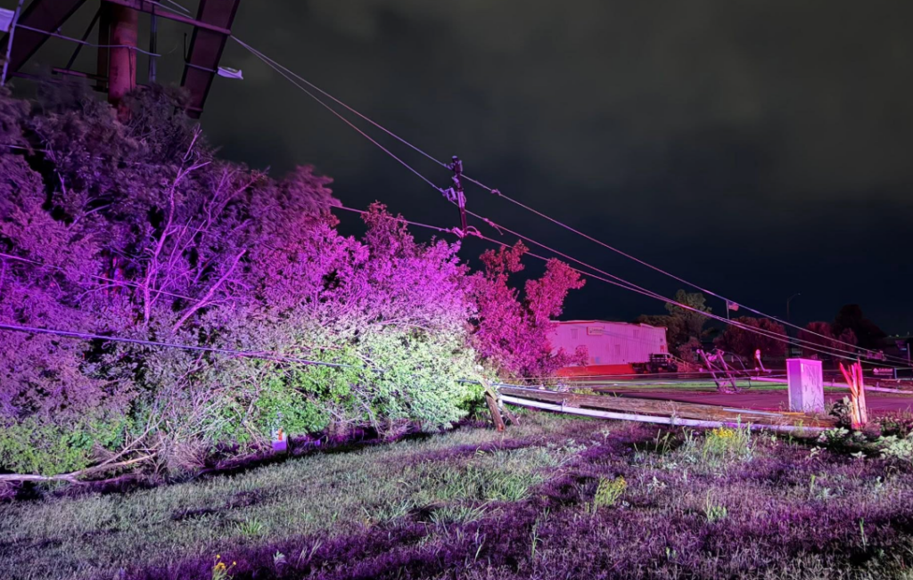
- Massive Power Outages: Multiple power flashes were captured on camera in El Reno around 1:30 a.m. as transformers blew and lines came down under severe thunderstorm and tornado warnings.

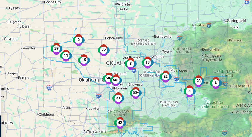
More Than 70,000 Without Power Across the State
The violent wind field took a heavy toll on the state’s electrical grid. According to data from Poweroutage.us on Monday morning, more than 70,000 utility customers are currently without electricity statewide.
The brunt of the damage is concentrated in the metro and northwestern rural pockets. OG&E Energy Corp. reports that over 43,000 of its customers are in the dark, with Oklahoma County accounting for the highest concentration at more than 22,000 outages. Further northwest, Woodward County is also sorting through significant grid damage, with over 2,000 customers reported without power this morning.
Utility crews are deploying across central and western Oklahoma to assess broken poles, clear snapped lines, and work toward safely restoring power.
Destructive Warnings for OKC Metro
As the line approached the capital city, the National Weather Service in Norman utilized urgent, all-caps language to underscore the immediate threat to life and property, warning residents: “THESE ARE DESTRUCTIVE STORMS FOR THE OKLAHOMA CITY METRO!”
Alongside the intense wind field, torrential rainfall rates dramatically reduced visibility to near zero across major highway corridors, creating treacherous conditions for late-night travelers and emergency responders. The system has since tracking east, leaving thousands of utility customers in central Oklahoma without electricity as utility crews deploy to assess broken poles and downed tree limbs this morning.
More Severe weather may be on the way this week as Chances are in the forecast again today through Wednesday.
You can help the Oklahoma Department of Emergency Management team by reporting your damage at damage.ok.gov.


