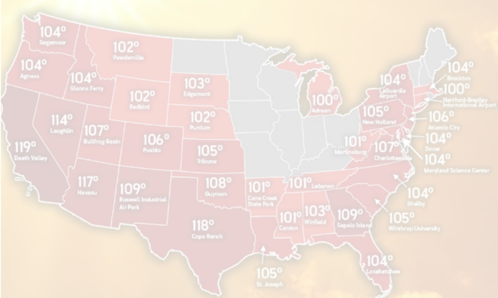
The persistent heat dome gripping Oklahoma and much of the region continues to hold strong, offering little immediate respite for agricultural producers looking ahead to the upcoming planting season.
Farm Director KC Sheperd recently spoke with Thomas Kines, Senior Meteorologist with AccuWeather, to discuss the stubborn weather pattern and what farmers and ranchers can anticipate in the coming months.
Kines noted that the high temperatures showing no sign of abating anytime soon, creating challenging conditions for agricultural operations across the region.
“If you’re one of those people rooting for cooler weather, it’s not happening anytime soon,” Kines explained. “It looks like at least for the next several days, temperatures are going to be way above where they should be at this time of year, and not out of the question that as we head into the weekend and maybe even early next week that we start talking about record highs.”
While extreme heat is typical for late summer in Oklahoma, Kines observed that elevated temperatures have been widespread across much of the United States over the past few months, though northern regions occasionally receive brief relief from cold fronts.
For producers assessing soil moisture conditions ahead of fall planting, the immediate outlook remains concerning. The strength of the current weather pattern has made it difficult for temporary relief to break through.
“This so-called heat dome has been very impressive,” Kines said. “It’s been tough to knock down, and in general, we think it’s going to stay put for the next several weeks, which is not good news for the folks that need the rain or any relief from the heat.”
Kines added that substantial near-term moisture would likely require a tropical system tracking into the Southern Plains to import tropical air without destructive winds. However, such a system is not in the immediate forecast.
Looking further ahead, agricultural producers are monitoring the development of a strong El Niño pattern. While some expected early weather changes, Kines clarified that El Niño impacts typically do not manifest during peak summer.
“It doesn’t necessarily affect our weather in the summer, but certainly can in the fall and the winter,” Kines noted. “So, there’s certainly hope for more moisture heading our way as we get closer to the fall and winter months.”
He emphasized that transition into an El Niño pattern is a gradual process rather than an instantaneous change. As autumn progresses into winter, the typical storm track is expected to shift across the Southern Rockies and Gulf Coast states, drawing in moisture from the Gulf of Mexico.
“Certainly looks cooler than what we would normally have, and that could just be a product that there’d be more cloudy days,” Kines said regarding the winter outlook. He also noted that because the forecasted El Niño is particularly strong, the wetter pattern could potentially persist into the spring planting season.