
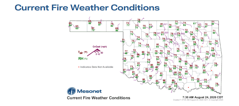
A stalling cold front coupled with triple-digit temperatures will drive peak wildfire danger across Oklahoma on Monday, August 24, 2026. The Oklahoma Department of Agriculture, Food & Forestry (ODAFF) Oklahoma Forestry Services (OFS) reports that the highest fire danger indices of the week will focus on the southwestern quadrant of the state as a frontal boundary pushes in and stalls near the Interstate 40 corridor.
Recent Fire Activity and Suppression Statistics
From August 18 through August 23, OFS recorded multiple fires across eastern districts:
- Northeast Area: 4 fires burned 38.3 acres, all attributed to incendiary causes.
- East Central Area: 8 fires burned 90.3 acres (4 escaped debris, 4 incendiary).
- Southeast Area: 23 fires burned 386.2 acres (14 lightning, 2 escaped debris, 7 incendiary).
- Outside Initial Attack Area: 3 fires burned 398.0 acres with OFS resources engaged.
- Fire Department Activity: Local departments reported 24 fires burning 1,214.6 acres via the OFS Wildfire Reporting Tool.
- Large/Significant Fire Activity: No new large activity was reported.
OFS resources currently mobilized include the OFS Suppression Group in Weatherford and the OFS Task Force in Goldsby.
Regional Fire Weather and Behavior Outlook
- Western and Southwest Oklahoma: Temperatures are forecast to reach 100° to 112° ahead of the front, with fine-dead fuel moisture dropping to 4% under relative humidity values of 20% to 27%. Midday southwest-to-west winds of 10 to 15 mph with gusts up to 25 mph will push rangeland head fires to spread rates of 90 to 135 ft/min and flame lengths of 9 to 13 feet. Mixed brush fuels could see flame lengths of 13 to 18 feet with torching and spotting. Rain chances remain low Tuesday and Wednesday evenings.
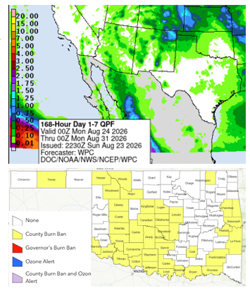
- Oklahoma Panhandle and Northwest Oklahoma: Monday brings temperatures of 95° to 100° and fine-dead fuel moisture around 5%. Northerly winds of 6 to 11 mph will hold rangeland spread rates to roughly 85 ft/min with flame lengths of 6 to 10 feet. Storm chances increase Tuesday afternoon and evening, returning Wednesday evening.
- Central Oklahoma: Highs will range from 96° to 106° on Monday with variable winds of 5 to 12 mph and relative humidity between 29% and 35%. Grass fuels present spread rates of 55 to 80 ft/min, while timber fuels will see spread rates around 25 ft/min. Conditions moderate north of I-40 by Wednesday, while areas south of I-40 will continue to experience problematic initial attack activity.
- Eastern Oklahoma: Oppressive heat continues along and south of I-40 with temperatures topping 100° and humidity falling below 35%. Good overnight moisture recovery will compress active burning to afternoon and evening hours. Pine-dominated stands can support spread rates exceeding 35 ft/min with flame lengths of 4 to 7 feet, accompanied by torching and spotting.
Statewide Seven-Day Outlook
A secondary trough will bring cooler, above-normal temperatures north of I-40 later in the week along with improved rain chances for the Panhandle. While overall significant fire potential remains low, sparse rainfall and high temperatures mean wildland fires will present suppression challenges and resistance to control throughout the near term. Elevated fire conditions are projected to return by next weekend.