
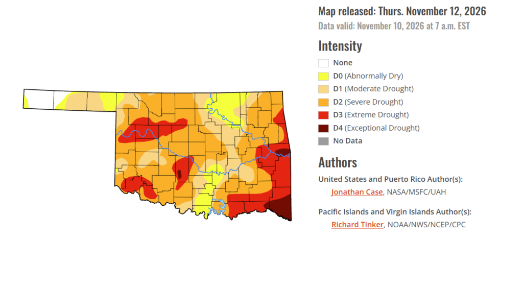
To view the latest Oklahoma drought map, CLICK HERE.
Drought continues to be a concern across Oklahoma as dry conditions remain a challenge for farmers, ranchers and communities heading deeper into November. While the state could use more widespread moisture to help ease ongoing drought stress, the forecast is offering some hope for additional rainfall in the days ahead.
According to the Drought Monitor, exceptional drought has increased slightly this week, now covering 2.52% of the state compared to .80% last week.
Moderate to extreme drought conditions in the current period affect 86.40% of the state. At this point, 3.13% of the state has no drought conditions.
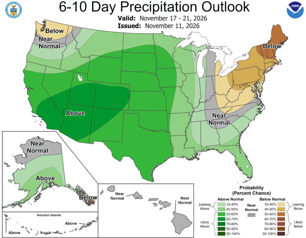
According to the 6-to-10-day precipitation outlook map, all of Oklahoma is leaning above a 50-60% chance of rain through November 21st.
This week’s drought picture featured a mixed bag of conditions with worsening drought in the lower Mississippi valley and the lower Great Lakes region. Meanwhile, prolific rainfall continued in parts of the Southwest, South, and Southeast, leading to significant drought improvement across southern and western Texas and parts of the Southern Appalachian region. Additional drought improvement was found over the western Great Lakes in Minnesota and Wisconsin and parts of the Upper Peninsula of Michigan. Despite little rainfall in the Four Corners region of the Southwest, additional improvements were made as a result of substantial rainfalls over the last several weeks, leading to tremendous flooding in some places and rapidly-filling reservoirs.
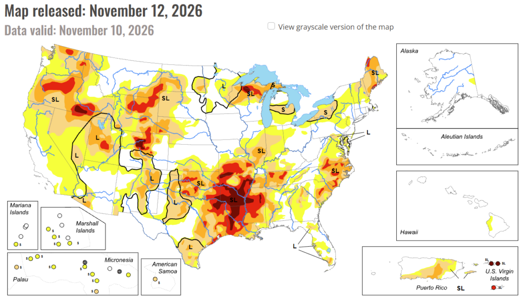
In the South: The drought pattern continued to be quite polarized across the Southern States, with exceptional drought worsening across Arkansas, Louisiana, Mississippi, Southeastern Oklahoma, and Eastern Texas. According to the National Centers for Environmental Information, 20 to 30 inches of rainfall is required over the span of 3 months to end the exceptional drought in these states. In stark contrast, substantial rains fell in Southern and Western Texas resulting in one and two categorical reductions in drought intensity, especially over South Texas where up to 9 inches of rain fell. Significant drought relief occurred across much of Western and Central Tennessee where several inches of rain fell in some places this past week helping to reduce the extreme drought to some extent.
In the High Plains: The High Plains States were the least active in terms of drought category changes this past week as little precipitation fell. With evaporation rates reduced this time of year, any worsening drought moves at a much slower pace. Only spotty drought improvements from rainfall occurred in Eastern South Dakota into Northeastern Nebraska, and Southwestern Kansas.
In the West: Despite an overall lack of substantial rainfall in the West this past week, continued drought improvements were made across many states from Southeast Montana southward to New Mexico and westward to Southern California and Nevada. Near-record soil wetness has resulted from the recent weeks of tremendous El Niño-influenced rainfall. It hasn’t been all good news in the West, as some drought degradation was introduced in northern Idaho and northwestern Montana this past week.
To view the 6-10 Day Precipitation Outlook Map, click here.
To view the 6-10 Day Temperature Outlook Map, click here.
To view the Monthly Drought Outlook Map, click here.