Dry conditions, dormant fuels, and a powerful weather system have converged to create a high-stakes wildfire environment across Oklahoma. The Oklahoma Department of Agriculture, Food & Forestry (ODAFF) released a Fire Situation Report for March 26, 2026, indicating that Oklahoma Forestry Services (OFS) is currently managing multiple large-scale incidents while bracing for extreme fire behavior today.
Statewide Fire Activity and Current Stats
Initial attack activity remains steady across the state. On March 25, reporting showed:
- Northeast Area: 5 fires burned 724.8 acres (Causes: 2 escaped control burns, 3 incendiary).
- East-Central Area: 4 fires burned 1,324 acres (Causes: 2 escaped control burns, 2 incendiary).
- Southeast Area: 2 fires burned 223 acres (Causes: 1 escaped control burn, 1 other).
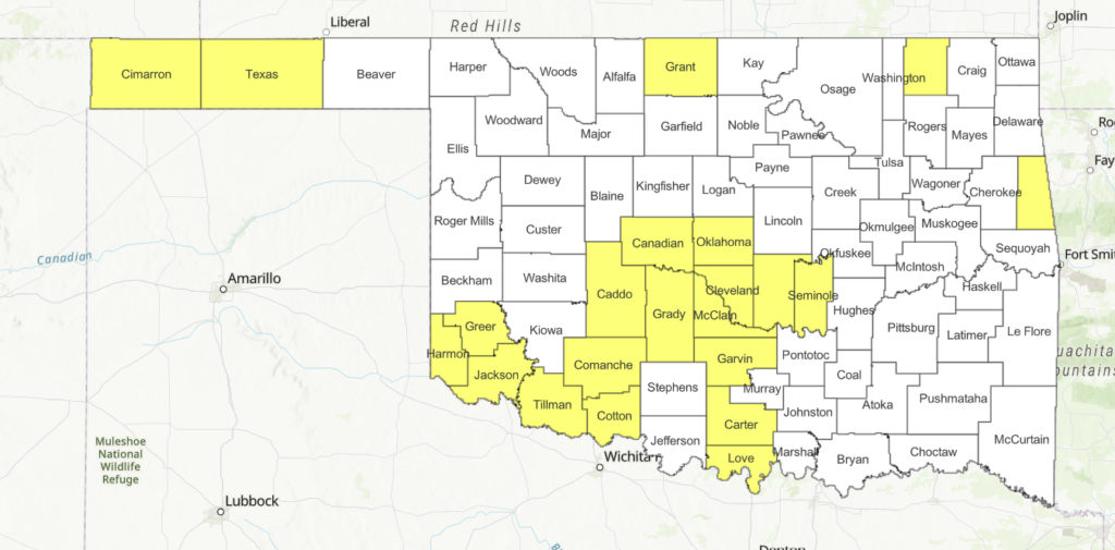
Currently, there are nearly 20 large or significant fires (defined as over 100 acres in timber or 300 acres in grass) active on the landscape. Some of the most significant include:
- Iron Post Fire (Cherokee County): 1,304 acres, 50% contained.
- Luna Branch Fire (Adair County): 1,279 acres, 50% contained.
- Sonny Gile Fire (Adair County): 1,217 acres, 65% contained.
- Pumpkin Hollow Fire (Cherokee County): 1,129 acres, 75% contained.
- Zipperer Fire (Mayes County): 1,000 acres, 10% contained.
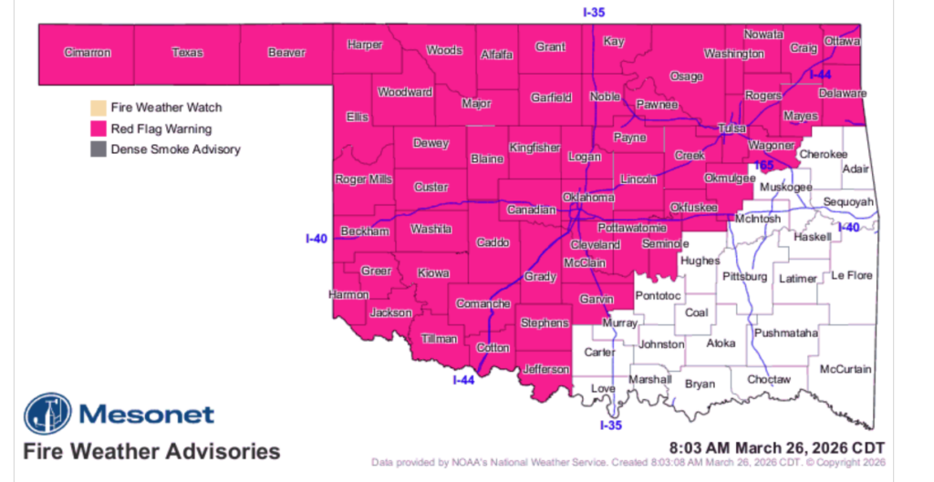
Extreme Weather and “Red Flag” Conditions
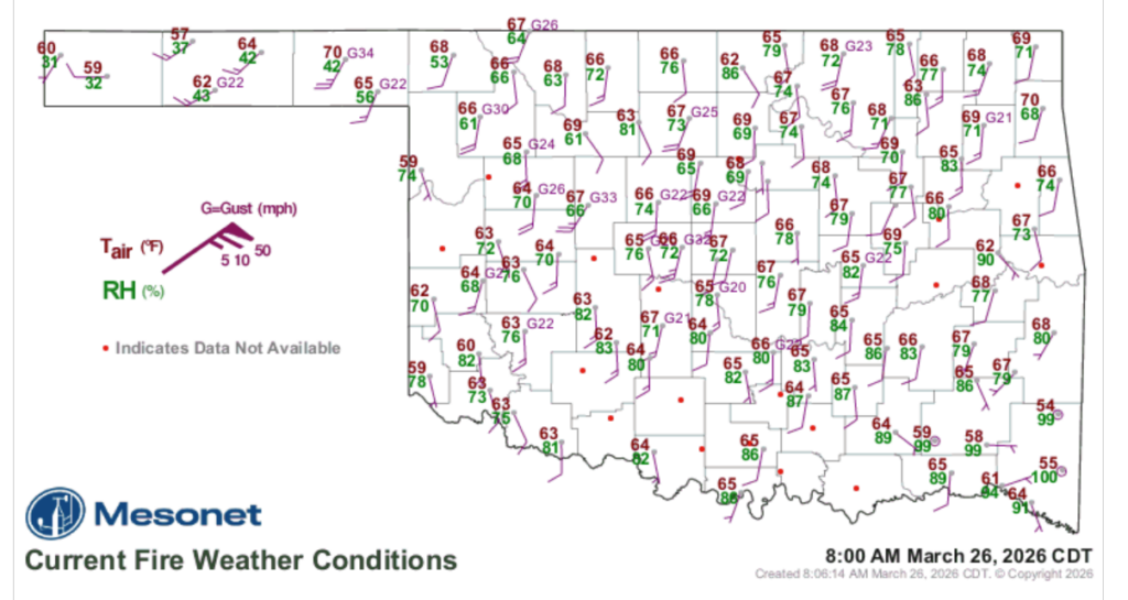
A Red Flag Warning is in effect for a large portion of the state today. Forecasters are watching a cold front navigating toward Oklahoma tonight, but the pre-frontal conditions are hazardous. High temperatures, very low relative humidity, and intensifying winds are expected to drive “rapid to extreme” rates of fire spread.
Regional Breakdown for Today:
| Region | Expected Highs | Rel. Humidity | Wind Gusts | Fire Behavior |
| Panhandle/NW | 94°–101° | 5–20% | 30+ mph | 15–21 ft flame lengths; spotting up to 1/4 mile. |
| West/SW | 93°–100° | 12–25% | 40 mph | Rates of spread up to 340 ft/min; extreme behavior. |
| North-Central/NE | Mid-90s | 25–30% | 40 mph | Torching, crowning, and spotting common in mixed fuels. |
| South-Central/SE | High 80s–90s | 27–35% | 35 mph | Problematic fire behavior in pine plantations and timber. |
Operational Response and Outlook
An Interagency Fuels & Fire Behavior Advisory has been issued in coordination with federal and surrounding state agencies. OFS has mobilized suppression groups—including engines, dozers, and overhead personnel—to strategic hubs in Guymon, Woodward, Weatherford, Stillwater, and Ardmore.
The approaching cold front will bring a significant temperature drop on Friday, with many areas seeing highs only in the 50s. However, this front brings a dangerous wind shift. As the wind pushes from the east, fire crews will have to pivot their strategies to protect the western flanks of any ongoing fires.
While fire weather may moderate slightly on Saturday, another “attention-getting” pattern is expected next week. This upcoming system is forecasted to bring continued wildfire risk to Western Oklahoma while shifting toward rain and storms in the East.
Farm Director KC Sheperd notes that the combination of triple-digit temperatures in the west and established large fires in the east creates a dual-threat scenario for state resources.