

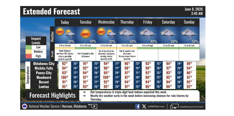
Climatological summer may have only officially kicked off on June 1, but Mother Nature is already cranking the thermostat straight to vintage mid-July. A sweeping heat wave has settled over Oklahoma, triggering the hottest stretch of weather for the warm season thus far and pushing heat index values into territory rarely seen this early in June.
According to Oklahoma State Climatologist Gary McManus, this early arrival of extreme summer heat continues a trend of unseasonable warmth that stretches back several months. In fact, looking at the broader patterns, McManus noted that, for all intents and purposes, we can call this year’s warm season starting in February.
A Shock to the System
While early June can certainly bring hot days to the southern plains, the intensity of this current stretch is drawing comparisons to the dog days of late summer. McManus pointed out that just looking at the morning low temperatures screams July 18th.
When the daytime sun beats down on moisture left behind by recent rains, the humidity is driving the “feels like” temperatures to jarring levels.
“Seeing that heat index soar 5-10°F above the actual air temperature is a bit jarring, but again…it’s summer,” McManus said.
Oklahomans are seeing those heat index values push into the 105 to 110-degree range, which is a bit early even for Oklahoma. Data from the Oklahoma Mesonet highlights just how rapidly this heat wave is expanding:
- Current 2026 Peak: The highest heat index recorded on the Mesonet so far this year was 107 degrees, observed at Medford back on May 31, with a slew of 105-degree readings over that and the following day.
- Rapid Multiplier: Prior to this week, there had only been 238 instances of a heat index of at least 100 degrees across the Mesonet’s 120 environmental monitoring sites.
- The Outlook: McManus stated he expects that triple-digit heat index number to multiply quite rapidly over the next few days.
Rain Relief on the Horizon
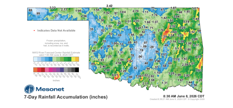
If there is a silver lining to the stifling humidity fueling these high heat indexes, it is the residual moisture left behind from previous storms.
“At least we had substantial rainfall for many over the last week, and at least SOME rainfall for everybody,” McManus said.
Of course, Oklahoma weather rarely distributes moisture evenly. McManus noted that there is always somebody that misses out on the good stuff, and this time around it was central Oklahoma.
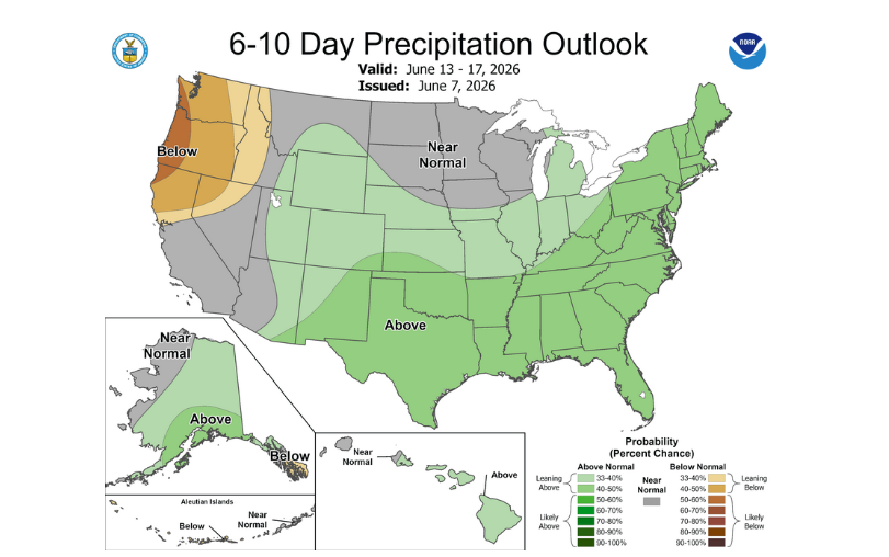
The hot, heavy air hanging over the state has even triggered some immediate, localized downpours to kick off the week. Looking further ahead, the long-term forecast suggests residents will not have to endure a prolonged dry spell before the next widespread round of relief arrives. McManus said the best news is we shouldn’t see a long period before rainfall returns, hopefully later this week.


