

Oklahoma severe weather remains at the forefront of agricultural concerns as the state navigates a record-breaking spring and eyes a potential transition to a “Godzilla” El Niño. Farm Director KC Sheperd recently spoke with State Climatologist Gary McManus to break down erratic rainfall patterns, the persistent drought in the Northwest, and what shifting Pacific Ocean temperatures mean for the months ahead.
A Record-Breaking Spring
The state has already seen a historic start to the year, tying the January record with five tornadoes and shattering previous marks in March. McManus noted that while Oklahomans are accustomed to volatile conditions, the frequency this year has been notable.
“It’s been a pretty active spring so far,” McManus said. “Just never a dull moment in Oklahoma”.
The Rainfall Lottery
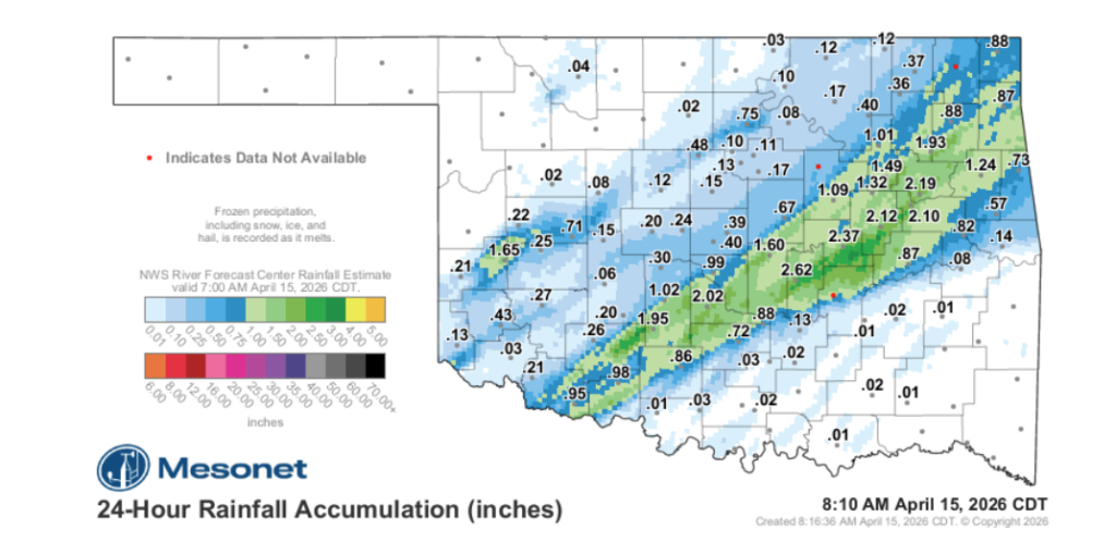
For producers, the recent weather has been a game of “haves and have-nots.” While a swath of the state from the Southwest through the Northeast has received beneficial moisture—some areas seeing up to 9 inches—other regions remain parched.
- The Winners: Areas from Grandfield through Ada and up to Jay have seen significant relief.
- The Losers: Northwest Oklahoma remains in dire condition, with some areas receiving less than a tenth of an inch of rain in recent days.
- The Trade-off: McManus highlighted that in Oklahoma, moisture often comes with a price. “If you want rainfall, you’re probably going to get that severe weather too,” he remarked.
The Rise of “Godzilla” El Niño
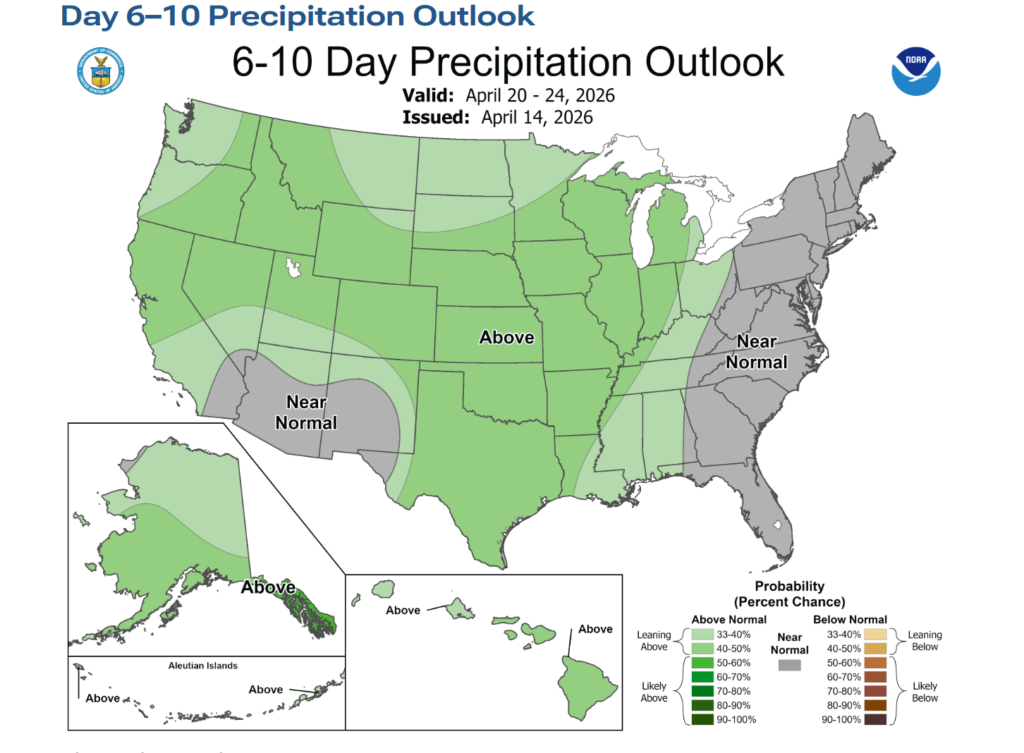
As the state moves out of a “triple-dip” La Niña—which fueled years of drought—all eyes are on the developing El Niño. Forecasters are currently tracking a 90% chance of development, with a 50% chance it could reach “strong to super-strong” status, often nicknamed a “Godzilla” event.
“El Niño famously brings the southern tier of the United States, including Oklahoma, cooler than normal and wetter than normal conditions,” McManus explained. He noted that while the impacts are primarily felt from late fall through early spring, the sheer amount of warm water under the Pacific surface suggests a significant event is brewing.
Drought Monitor Discrepancies
McManus also addressed farmers’ frustrations with the U.S. Drought Monitor, which can sometimes seem “behind” real-time conditions. He explained that the map is essentially a snapshot of conditions as of Tuesday morning, meaning heavy rains on a Wednesday won’t appear until the following week.
Furthermore, the monitor relies heavily on drought index values rather than immediate visual impacts. “They don’t use the impacts that we’re seeing by and large… it’s going by those drought index values,” McManus said, noting that this can complicate the triggering of aid programs like the LFP (Livestock Forage Program).
The Week Ahead
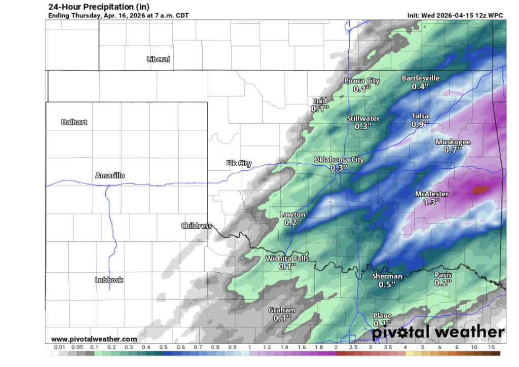
While the drought remains critical in the Northwest, McManus offered a glimmer of hope for the rest of April and May, Oklahoma’s wettest month. However, immediate relief may be interrupted by a sharp cold front following a high-risk severe weather window.
“Friday looks like maybe the highest risk categories we’ve seen for the year thus far,” McManus warned, though he noted a more tranquil, cooler weekend with lows in the 30s and 40s is expected to follow.

To read more from Gary McManus on his mesonet ticker, click here:


