

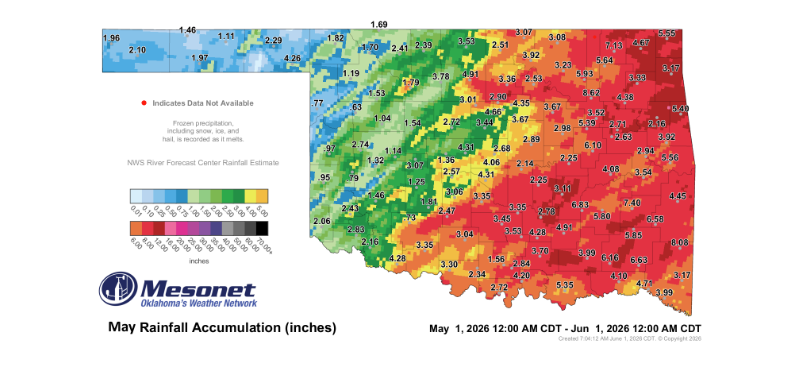
Oklahoma’s weather has shifted dramatically into a pattern of widespread precipitation, providing a much-needed reprieve for large portions of the state following an exceptionally dry May. State Climatologist Gary McManus noted that the sudden transition mirrors a dramatic turnaround, with several regions already accumulating more rainfall during the first half of June than they recorded throughout the entire preceding month.
While the moisture is a welcome development for agricultural and hydrological recovery, the distribution remains uneven across the state’s diverse climate zones.
Uneven Relief Across the State
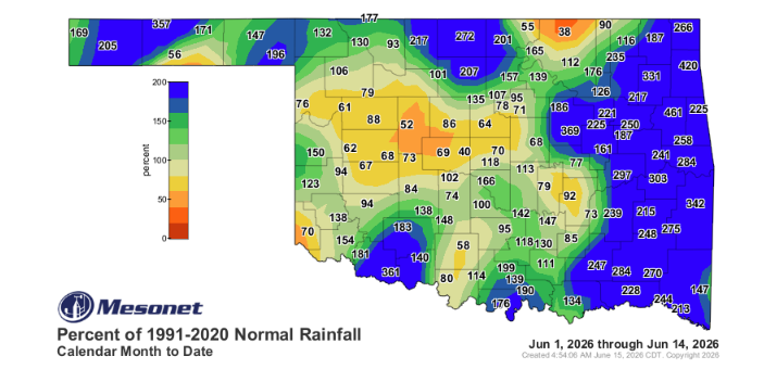
Despite the overall boost in moisture, significant regional deficits persist. The June rainfall distribution highlights a stark contrast between recovering areas and those still locked in dry conditions. Eastern Oklahoma has absorbed the majority of the recent bounty, while several communities in the western half of the state and the Panhandle continue to experience severe deficits.
According to the latest Mesonet data, locations such as Goodwell, Watonga, Foraker, and Hollis have largely missed out on the heaviest downpours, leaving these areas vulnerable to ongoing moisture stress.
Severe Wind and Weekend Storms
The moisture arrived alongside intense, localized, severe weather. Late last week, powerful convective systems swept through the Panhandle, producing destructive wind gusts. On Friday night at 9:10 p.m., the Oklahoma Mesonet station at Eva registered a massive 96 mph wind gust, followed by a secondary 70 mph gust just ten minutes later.
The Week Ahead: A Brief Lull Before Rising Temperatures
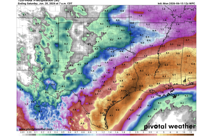
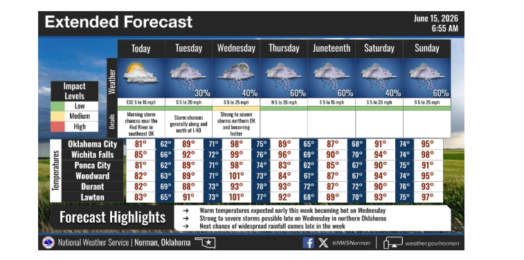
Current weather models indicate that while ongoing scattered showers are tapering off, the overall pace of precipitation will slow down significantly through the remainder of the week. However, a significant shift is projected mid-week. Wednesday is forecast to bring a sharp increase in heat and humidity, tracking as the most intense atmospheric setup of the week.
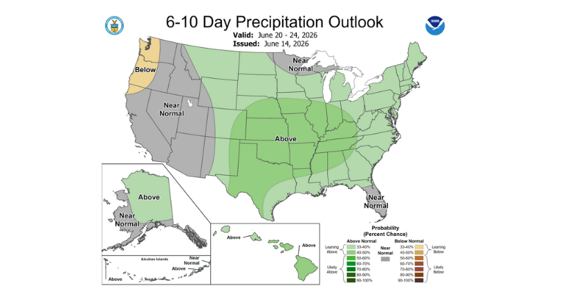
Looking further ahead into next week, early long-range forecasts suggest the potential for another active weather pattern that could bring additional chances of rainfall to the state.
To read more from State Climatologist Gary McManus on his mesonet ticker, click here: