
Oklahoma is officially fully engulfed in drought, with 100% of the state now experiencing at least Moderate Drought (D1) conditions according to the latest U.S. Drought Monitor update. This marks the first time since November 1, 2022, that every part of the state has met the moderate drought threshold.
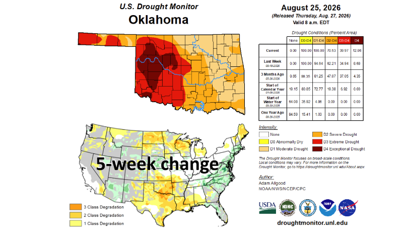
Severe conditions continue to expand rapidly across the state. Extreme to Exceptional Drought (D3–D4) now covers 40% of Oklahoma, the highest percentage recorded since October 29, 2024. Additionally, 12% of the state is gripped by Exceptional Drought (D4)—the most severe category on the Drought Monitor scale—reaching levels not seen since April 25, 2023.
State Climatologist Gary McManus noted that the worsening conditions are fueled by a severe combination of persistent deficits in rainfall and punishing heat over the past two months, which intensified further through August.
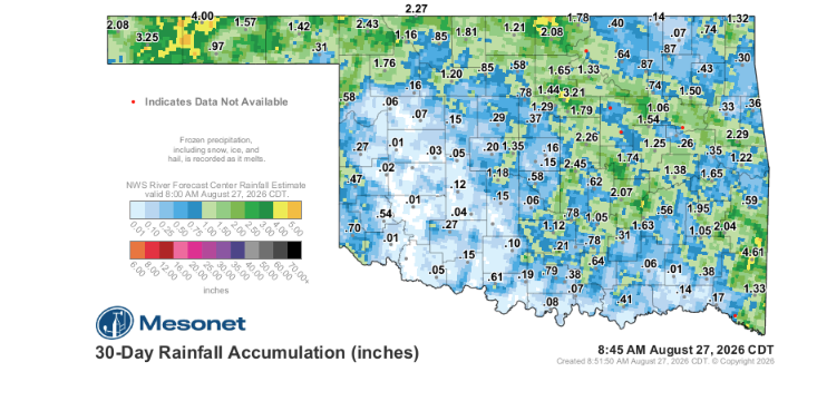
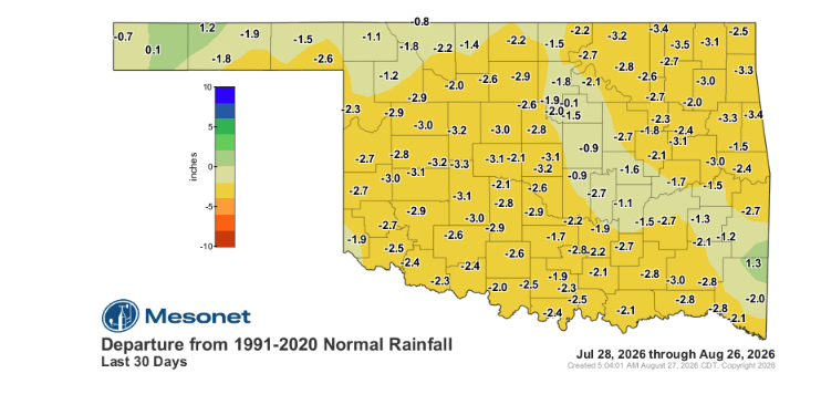
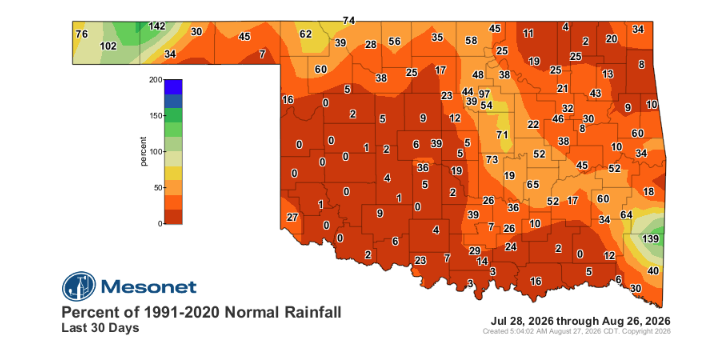
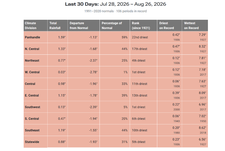
The 30-day period from July 28 through August 26 ranks as the fifth-driest on record statewide. Regional impacts are even more severe in western Oklahoma, where both West-Central and Southwest Oklahoma recorded their driest 30-day stretch in recorded history. With the exception of isolated areas in the Panhandle and far southeastern Oklahoma, moisture levels across the state remain critically below normal.
August is projected to finish among the top five driest and hottest on record, potentially ranking as the third-hottest August in state history behind only 2011 and 1936.
Historically, only three Augusts in Oklahoma’s climate record dating back to 1895 have averaged triple-digit daily highs statewide:
- 1936: 102.2°F
- 2011: 101.6°F
- 1943: 100.6°F
The current statewide average high for August stands at 101.0°F.
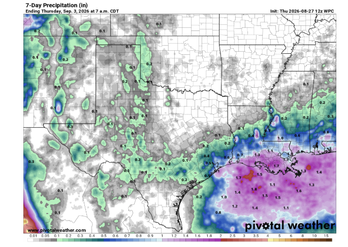
While a brief break brings highs into the 90s, temperatures remain 5 to 10 degrees above the seasonal average of approximately 90°F. Triple-digit heat is forecasted to return quickly and dominate through the first week of September. Long-range outlooks indicate the possibility of a fall cold front arriving around Labor Day that could introduce cooler temperatures and rain chances, though widespread, drought-breaking moisture remains hard to come by until weather patterns shift significantly.
To read more from State Climatologist Gary McManus on his Mesonet ticker, click here: