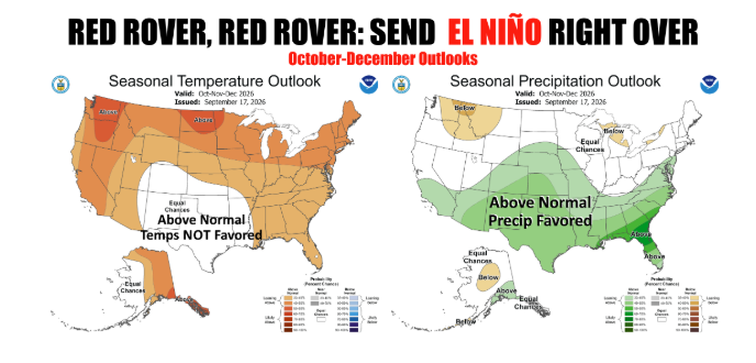
Oklahoma agricultural producers battling a brutal summer flash drought are finally staring down a promising forecast. The latest three-month outlooks released by the NOAA Climate Prediction Center (CPC) point toward a developing, potentially historic El Niño that could bring widespread, much-needed moisture across the Southern Plains from mid-fall through winter.
According to Oklahoma State Climatologist Gary McManus, the CPC’s updated October-through-December projections lean heavily into a classic, dominant El Niño setup. Forecasters now place the probability of a “very strong” event this fall and winter at greater than 90 percent. Furthermore, there is a 75 percent likelihood that the October-through-December period reaches a RONI (Relative Oceanic Niño Index) of +2.5°C or greater. If realized, an anomaly of that magnitude would surpass every event on record dating back to 1950 by that metric.
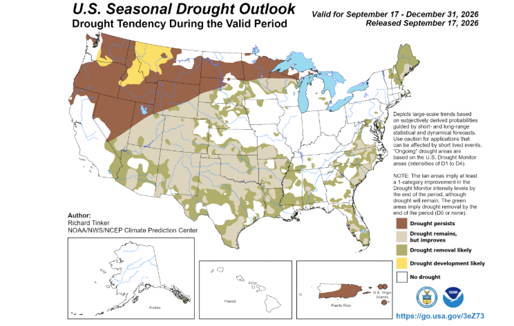
For Oklahoma farmers and ranchers, the most encouraging takeaway is the precipitation outlook. Following severe late-summer dry spells that caused drought intensification across western and southern Oklahoma, the CPC outlook anticipates substantial drought relief over the next three months. The large-scale weather pattern is projected to shift toward frequent storm systems traversing the state, driven by dynamical models, statistical guidance, and the eventual formation of an active winter subtropical jet stream across the southern tier of the United States.
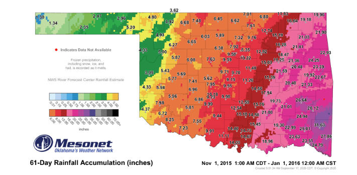
McManus noted that the October-through-December window marks the onset of the wet signal rather than its peak, with wet conditions projected to persist straight through the core of winter. When Oklahoma experienced its last “super” El Niño during 2015–16, the state recorded its second-wettest November and wettest December on record, predominantly as rain until a severe winter storm struck after Christmas. While increased storm frequency does improve chances for frozen precipitation, winter weather outcomes will depend entirely on whether cold air masses align with individual storm tracks.
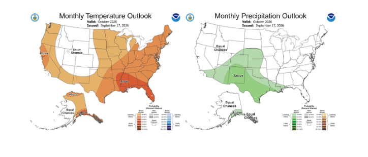
Temperatures present a mixed picture in the transition period. The CPC October outlook shows elevated temperature probabilities, primarily because dry antecedent soils reduce latent cooling and increase sensible heat. However, for the full October-December period, the CPC assigned “Equal Chances” for above-, near-, or below-normal temperatures across the Southern Plains, breaking a year-long streak of dominant above-normal heat signals.
A notable indicator of the system’s sheer scale came directly from the CPC discussion, which stated that the Madden-Julian Oscillation (MJO)—typically a critical driver of fall weather swings—was “not a factor” in the October forecast. Strong equatorial Pacific warming and coupled atmospheric winds are so entrenched that the El Niño itself is overriding transient tropical pulses.
Forecasters highlight two important caveats for producers planning winter pasture and wheat planting. First, the Pacific Decadal Oscillation (PDO) currently sits in a strongly negative phase (-1.11 in August), whereas previous monster El Niños in 1982–83, 1997–98, and 2015–16 occurred under positive PDO regimes, creating the potential to dampen classic precipitation responses. Second, outlooks represent a favorable shift in probability rather than a guaranteed outcome.
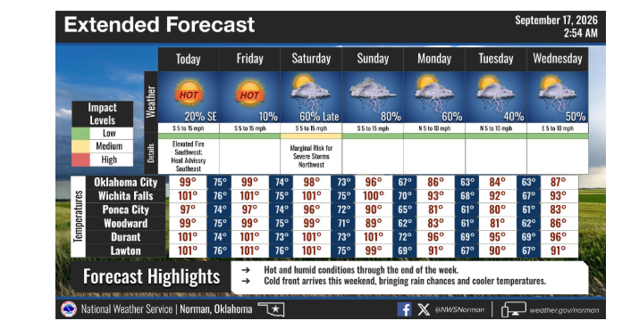
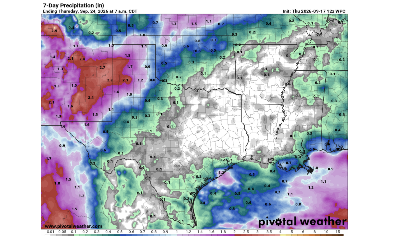
In the immediate term, triple-digit heat is winding down as rain chances increase over northern and western Oklahoma heading into next week. While El Niño impacts will build gradually into the winter months rather than arriving all at once, Oklahoma producers finally have a weather pattern heavily tilted in their favor.
To read more from State Climatologist Gary McManus on his mesonet ticker click here: