
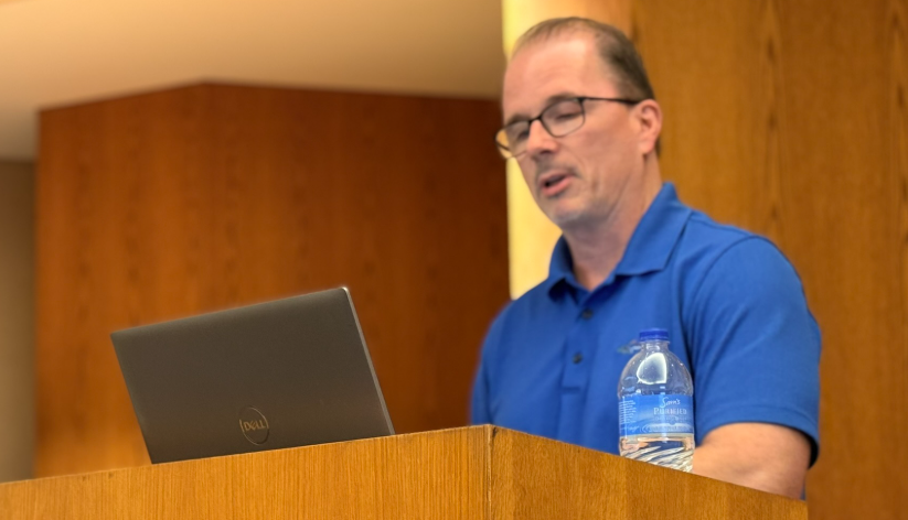
Oklahoma drought relief may finally be approaching as a strengthening El Niño pattern offers hope to parched agricultural lands, according to State Climatologist Gary McManus. Speaking with Farm Director KC Sheperd at a recent Drought Commission meeting, McManus outlined the harsh reality currently facing the state’s agricultural producers while presenting a more promising long-term outlook for moisture heading into late fall and winter.
Severe Ground Realities Across Oklahoma
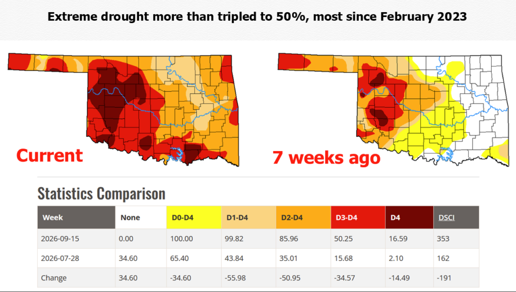
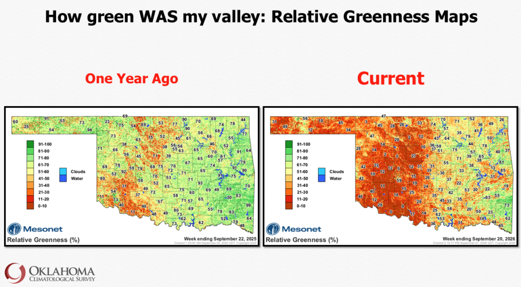
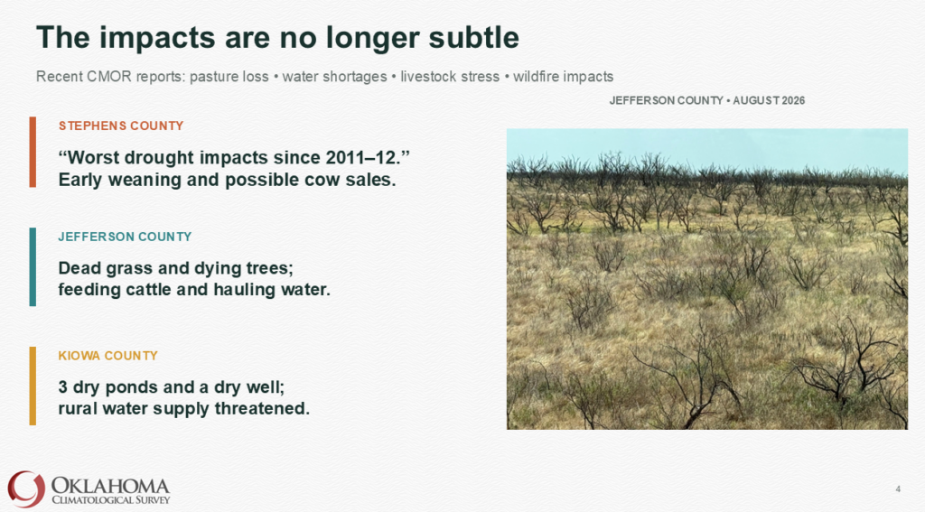
Conditions across much of Oklahoma remain in critical shape. McManus reported that extreme to exceptional drought blankets wide swaths of the state. The western half of Oklahoma into central regions has been hit hardest, with McManus noting that parts of western Oklahoma look like the surface of the moon. Northeast and southeast areas are also experiencing severe impacts. While a few isolated areas have received beneficial rains over the past few weeks, those events remain rare.
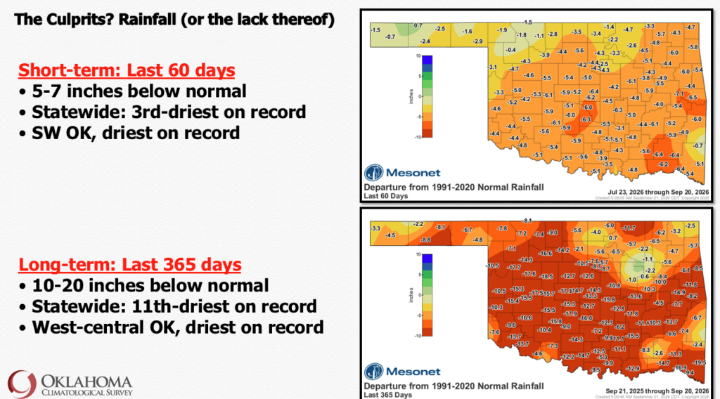
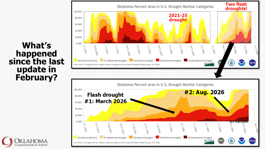
Over the trailing 365 days, southwest and west-central Oklahoma have recorded either their driest or second-driest year on record, with other areas ranking third or fourth driest. McManus pointed out that this intense dry spell has gripped the state continuously since August of last year.
Strengthening El Niño Offers Hope for Fall and Winter
The most hopeful shift in the forecast stems from the development of a powerful El Niño in the Pacific. McManus noted that the system is already strong, continues to strengthen, and is projected to reach “very strong,” “super,” or even historic levels.
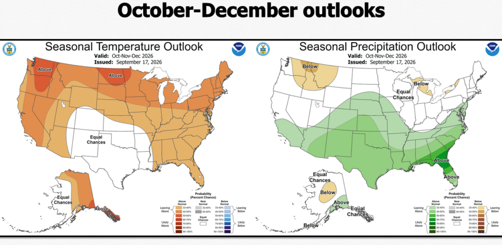
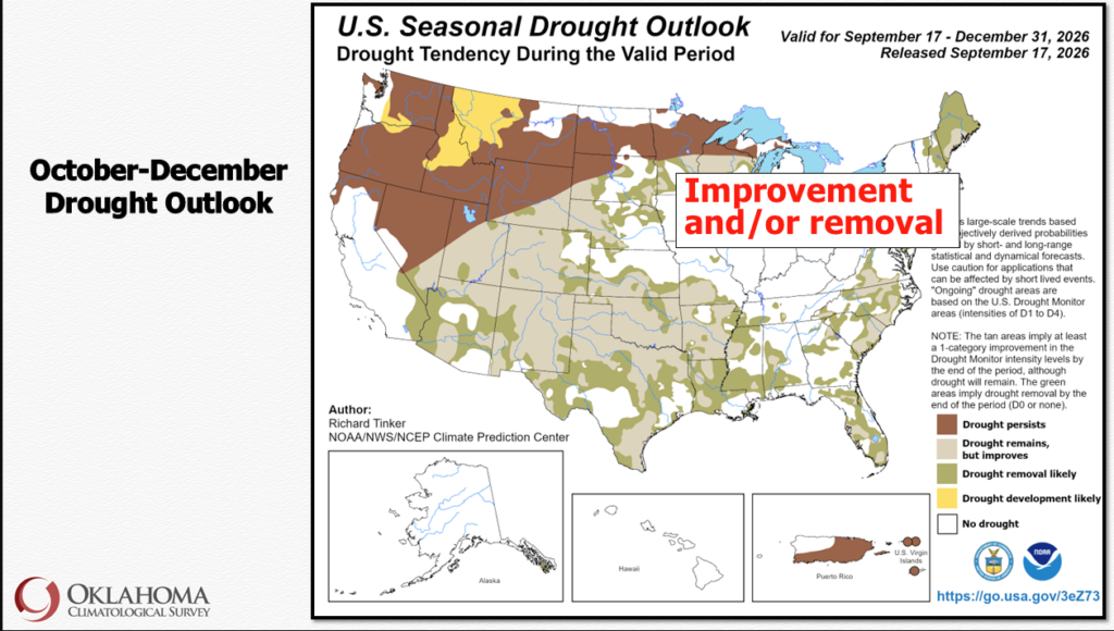
For Oklahoma and the southern tier of the United States, a strong El Niño historically tilts the odds toward wetter-than-normal conditions. Long-range outlooks show increased probabilities for above-normal precipitation spanning from October through March. McManus indicated that conditions are expected to lean wetter starting in October, November, and December. While this is not an absolute guarantee, it represents a dramatic and welcome change from the below-normal moisture forecasts producers endured over the past year.
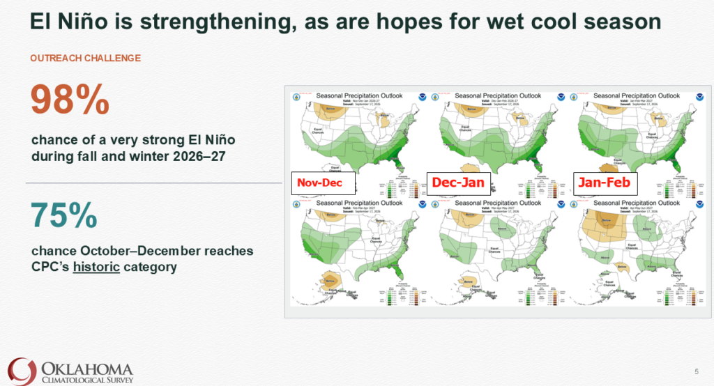
Regarding temperatures, outlooks currently show equal chances for above, below, or near-normal conditions. However, McManus noted that warmer-than-normal temperatures are no longer dominating the long-term charts. The pattern should produce more frequent storm systems, creating greater opportunities for winter precipitation. While ice storms and freezing rain remain an unwelcome hazard, snow would serve as an effective resource to replenish depleted soil moisture as it slowly melts into the profile.
Soil Absorption Concerns and Producer Guidance
Because the topsoil across much of Oklahoma has been baked hard by prolonged heat and dry weather, heavy downpours pose a risk of immediate runoff rather than deep soil absorption. McManus explained that the ideal scenario would feature slow, moderate rainfall events spaced across several days, followed by reinforcing rains within a week to gradually saturate the soil. While heavy runoff is not ideal for parched soils, it would at least help recharge dwindling farm ponds and local lakes.
McManus urged agricultural producers to treat long-range climate outlooks as a “nudge” rather than a definite “trigger” for operational decisions. Producers should continue implementing solid preparation practices without fully banking on moisture delivery.
McManus emphasized the critical need for local producers to consistently report conditions and ground impacts to the U.S. Drought Monitor. Because drought monitor authors rely heavily on index values rather than strictly on ground impacts, detailed local reports provide the essential proof needed to reflect ground-level realities and help trigger available aid programs. You can report drought to the CMOR or Condition Montioring observation Reports by clicking HERE.
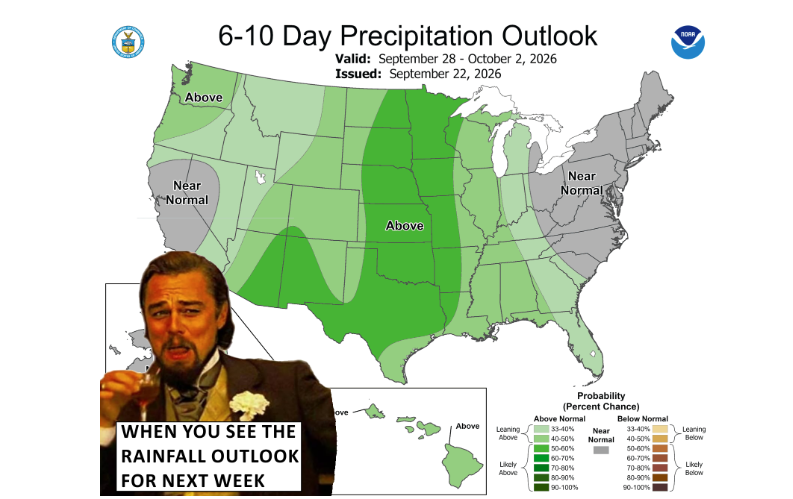
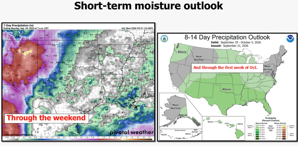
McManus says for the next few days the more substantial chances for widespread rain stays in western Oklahoma, with maybe some scattered showers to the east. But we should see that Pacific moisture plume continue into the High Plains over the next few days, possibly leading to some good rains in our Panhandle and far western Oklahoma.
But it’s later into the weekend and into next week that gives most of us hope for more widespread rain in other parts of the state. Looking at the longer range forecasts from 7-10 days out, those forecast, he says those rainfall amounts get a bit higher and more widespread.