

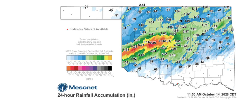
A relentless wave of heavy rainfall continues to pound western and central Oklahoma, delivering historic moisture to parched ground while creating localized flooding headaches as storms persist through Wednesday morning.
Oklahoma State Climatologist Gary McManus highlighted the sheer scale of the event, pointing out that several communities have seen unprecedented short-term totals.
“Sometimes, Ladies and Gentlemen, the fun is in overdoing it, right?” McManus said. “Take for instance, west-central Oklahoma. Places like Bessie, Elk City (there are no elks there…let’s be real!), and Hinton, who have received more rain in the last 12 hours than they’ve had since June! Heck, it’s raining right now for crying out loud!”
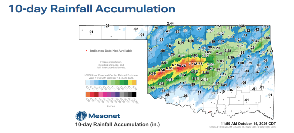
According to the Oklahoma Mesonet 3-day rainfall accumulation map from Wednesday morning, a heavy corridor of moisture extends across southwest, west-central, and central Oklahoma. Gauges in the southwestern section of the state recorded staggering totals exceeding eight inches, with the Mesonet logging a peak of 8.32 inches alongside surrounding measurements of 7.75, 6.54, 5.52, 5.33, and 4.91 inches.
Further east into west-central and central Oklahoma, amounts between 2.44 and 3.96 inches were widely recorded, while parts of northern and northeastern Oklahoma collected between 0.75 and 1.56 inches. Conversely, the far western Panhandle and southeastern Oklahoma largely missed out, recording mere fractions of an inch or remaining dry.
However, the rapid deluge has brought severe runoff and water management challenges alongside much-needed drought relief.
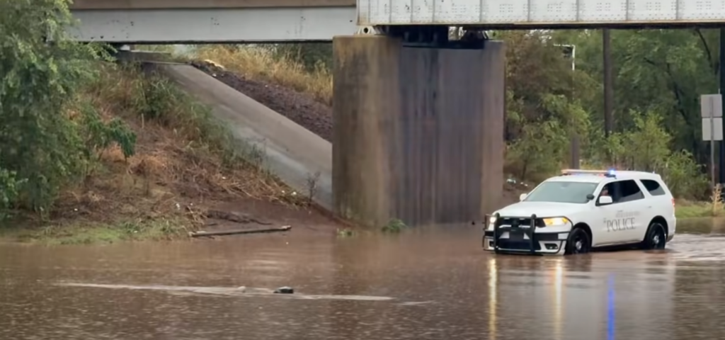
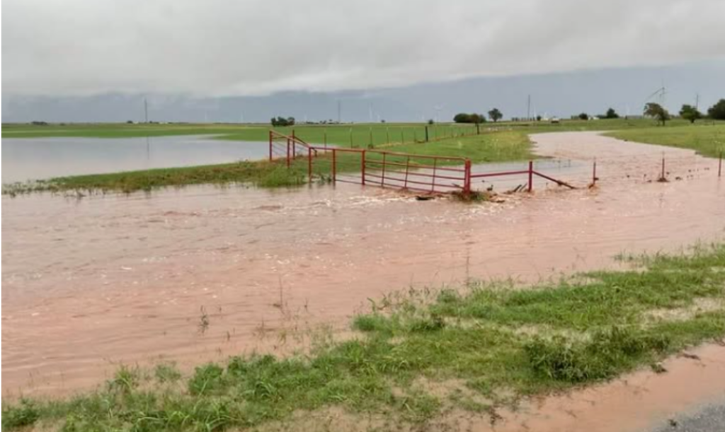
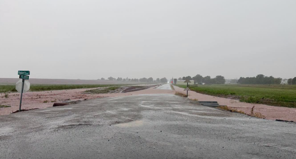
“All this rain in such a short time, as expected, has created widespread flooding problems across western Oklahoma, spreading east,” McManus warned. “That map ain’t pretty, and neither are these.”
McManus emphasized that the atmospheric pattern remains active and unpredictable throughout the day.
“It’s kind of a complicated setup today, dealing with stalled fronts and return warm fronts and outflow boundaries, so the best advice I can give on this one is to curl up in the fetal position and give up. NO NO NO, just stay weather aware and you’ll be fine. Stay in tune with your local authorities, Emergency Managers, NWS offices, and favorite media source. What’s past is prologue, folks.”
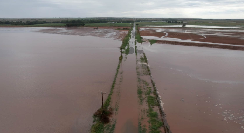
Here is the localized flooding and weather advisory details ready to integrate into your story:
- National Weather Service Flash Flood Warnings & Watches: The National Weather Service in Norman issued multiple Flash Flood Warnings and Flood Watches spanning western, central, and south-central Oklahoma through Wednesday afternoon. Warnings targeted corridors including northwestern Oklahoma County (Oklahoma City, Bethany, Warr Acres, and southwest Edmond) as well as Canadian, Grady, Caddo, and McClain counties where rainfall rates reached 1 to 2 inches per hour over saturated ground.
- Highway and Road Closures: Rapid runoff forced highway travel disruptions Wednesday morning, including high-water road closures along sections of I-40 west of the Oklahoma City metro near the Grady and Kingfisher county lines, along with localized creek and tributary overflow across low-water crossings.
- Stream and Tributary Overflow: Flood advisories and warnings flagged rapid rises on small creeks, low-lying rural bottoms, and pasture drainages stretching east toward Seminole, Ada, and Holdenville, inundating low-lying agricultural ground.
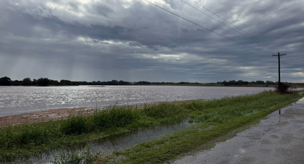
While the moisture provides long-term subsoil replenishment, the sheer velocity and volume of the runoff pose serious threats to crop producers actively in the middle of fall field work. With winter wheat planting advancing rapidly across western and central Oklahoma over recent weeks, torrential downpours can wash out freshly drilled seed, erode seedbeds, and leave standing water that drowns tender, emerging stands. Even where water drains relatively quickly, heavy pounding rainfall on exposed, cultivated ground frequently leads to severe soil crusting as the top layer dries. That hard crust creates an impenetrable barrier that prevents young coleoptiles from emerging, forcing producers to assess whether to run a rotary hoe to break the crust or incur the steep expense of replanting washed-out acres entirely. Furthermore, unharvested summer crops such as cotton and soybeans face immediate harvest halts, potential lodging, and seed quality deterioration from lingering field saturation.
With rain continuing to fall across active storm corridors, final precipitation totals will be updated once the system fully exits the state.