

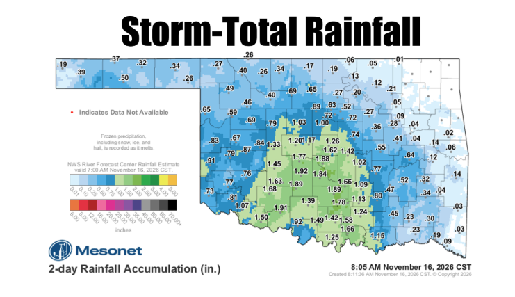
Oklahoma narrowly missed a major winter storm over the weekend, settling instead for a cold rain that brought localized relief to parts of the state while leaving eastern Oklahoma deeply entrenched in a growing moisture deficit, according to State Climatologist Gary McManus of the Oklahoma Mesonet and Oklahoma Climatological Survey.
McManus noted that temperatures were roughly 10 degrees shy of turning the system into a significant snowstorm. Instead, the storm delivered chilly rainfall across select pockets of the state, creating uneven totals across the Oklahoma Mesonet network:
- 15 Mesonet sites recorded at least 1.5 inches of rain.
- 18 sites received more than 1 inch of rain.
- 35 sites logged less than a quarter of an inch, including seven locations that recorded zero measurable precipitation.
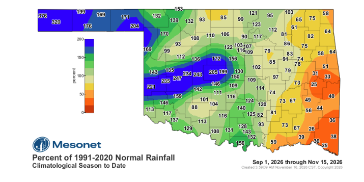
While parts of western Oklahoma continue to benefit from an active autumn pattern, the gap between the western and eastern halves of the state continues to widen as fall draws to a close. According to historical data spanning at least the past 100 years, the Oklahoma Panhandle is currently experiencing its 7th-wettest fall on record, and west-central Oklahoma is tracking its 9th-wettest fall. Conversely, southeast Oklahoma is enduring its 5th-driest fall in at least a century, while east-central Oklahoma ranks as its 25th-driest.
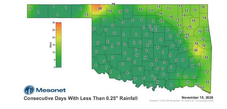
Consecutive days without significant rainfall continue to mount across eastern Oklahoma, compounding seasonal deficits for agricultural producers and water supplies in the region.
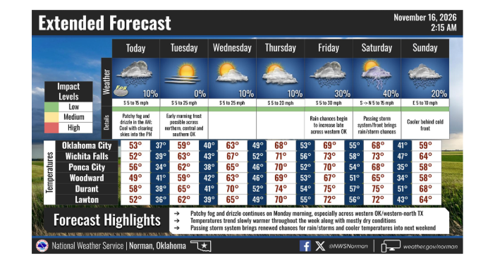
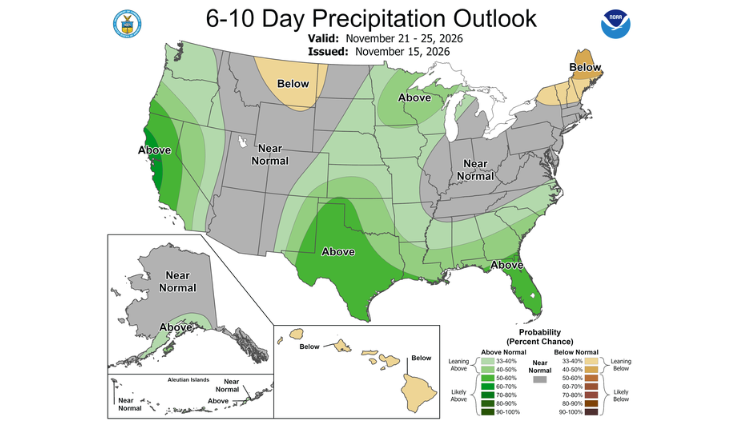
Looking ahead, McManus indicated that the next opportunity for precipitation arrives this upcoming weekend, though forecast models have been trending downward on expected totals. Additional moisture chances may emerge deeper into Thanksgiving week, offering a potential opportunity for broader relief before winter arrives.
To See More from Gary McManus on his mesonet ticker, click here: